As a sociologist who studies places, this always stands out to me when I visit New York City: its scale and size. Other American cities and places have small aspects of what New York has but NYC has more. Density, skyscrapers, mass transit, large parks, commercial activity, waterways, sidewalk life, a variety of neighborhoods, and history going back to the mid-1600s.
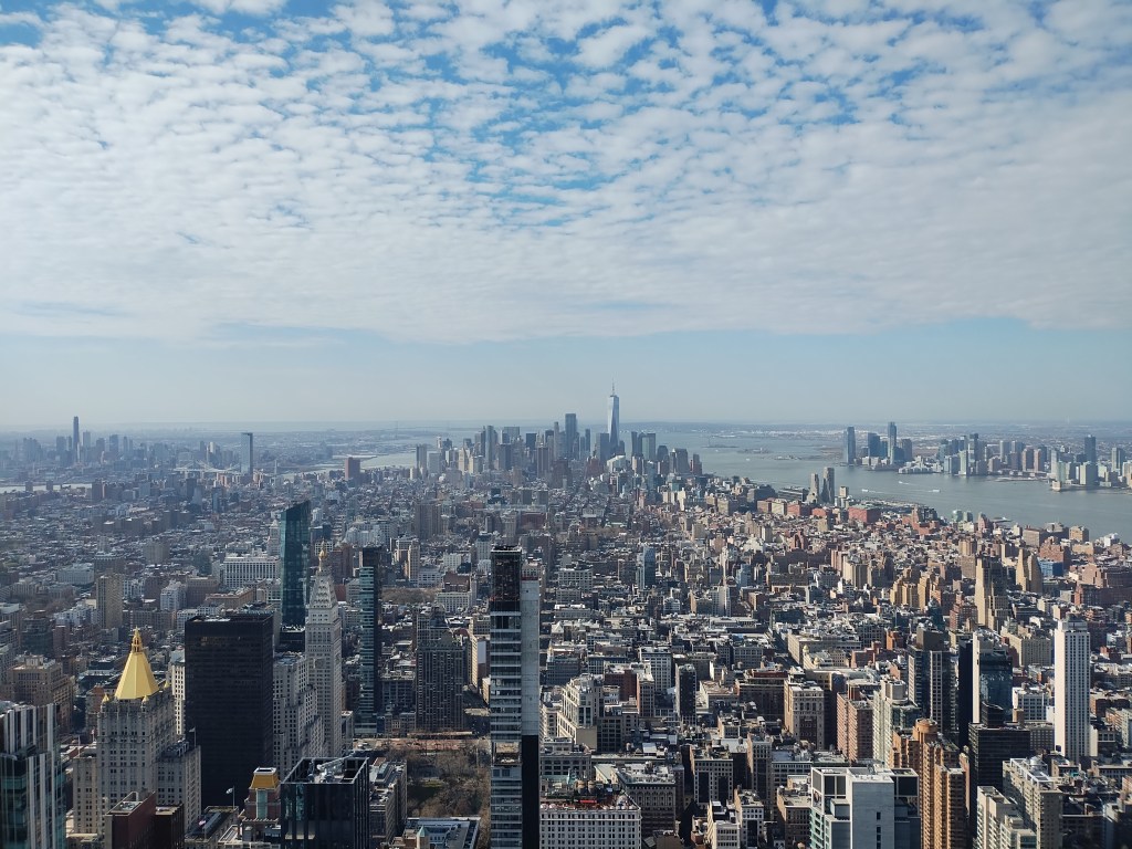
This might be most visible from up above. Coming in via airplane over New York City, you see the reach of the metropolitan region even before you get to the five boroughs. You see the tall buildings, not just in one location, but in multiple settings (midtown Manhattan, downtown Manhattan, along the rivers, in Brooklyn, in Jersey City, etc.). Development and human activity is evident everywhere. Standing at the top of the Empire State Building (picture above), you can hear some of the street noise even as you observe people and vehicles moving around.
But this is also evident at the street level. There is a level of activity across the city. Denser residential buildings and close-together single-family units. Tons of small businesses and restaurants as well as multinational corporations. Street traffic and overlapping mass transit systems that mean you can traverse the city without cars. Busy outlying neighborhoods in addition to the activity of Manhattan.
There is an argument that larger cities are scaled up versions of smaller cities. (See this book for an example.) I am more familiar with Chicago than New York City and for the Midwest, Chicago is the big city. But then travel to Los Angeles or New York – and I have been to both numerous times – and Chicago looks and feels smaller (even as LA and NYC are very different places). New York City is the big city for the United States. It is the leading global city in numerous lists and studies. Other big cities have their own unique features or have smaller versions of what New York has. As one quote says, “America has only three cities. New York, San Francisco, and New Orleans. Everywhere else is Cleveland.”
I have been in even larger cities like Tokyo and Hong Kong. From above and on the ground, both of these cities are on a different scale compared to New York City. But that is a possible story for future posts. For now, New York City is the big American city.