
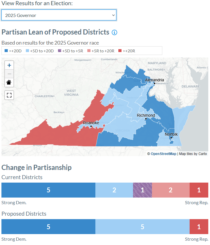
Elections in the United States are often decided by suburban voters. As voters in cities and suburbs closer to big cities tend to vote for Democrats and voters in rural areas and outer suburbs tend to vote for Republicans, the middle suburbanites are ones both parties want to capture. Where are those voters ending up in new congressional districts a number of states have mapped?
Two examples are worth looking at: first Virginia and then Texas.
And the old and new map in Texas:
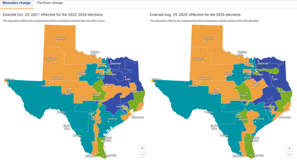
These maps shows some of the ways to neutralize voters the party in power does not want to get seats. This can take the form of long and skinny districts that go from near a big city and out into the countryside. Vary where this district starts and ends or the width of the district and those key suburban voters can be pulled in a direction that party wants.
This is often a shift away from more square or rectangular shapes that might cover geographies that are similar to each other: voters in big cities in a district with largely similar voters, suburbanites matched with suburbanites, and small towns and rural areas together.
How might this change the influence of the voters in middle suburbia? The 2026 mid-terms could offer some hints and I am sure there will be a lot of analysis ahead of the 2028 elections.
