Quantifiable running + big cities = “run-every-streeters”

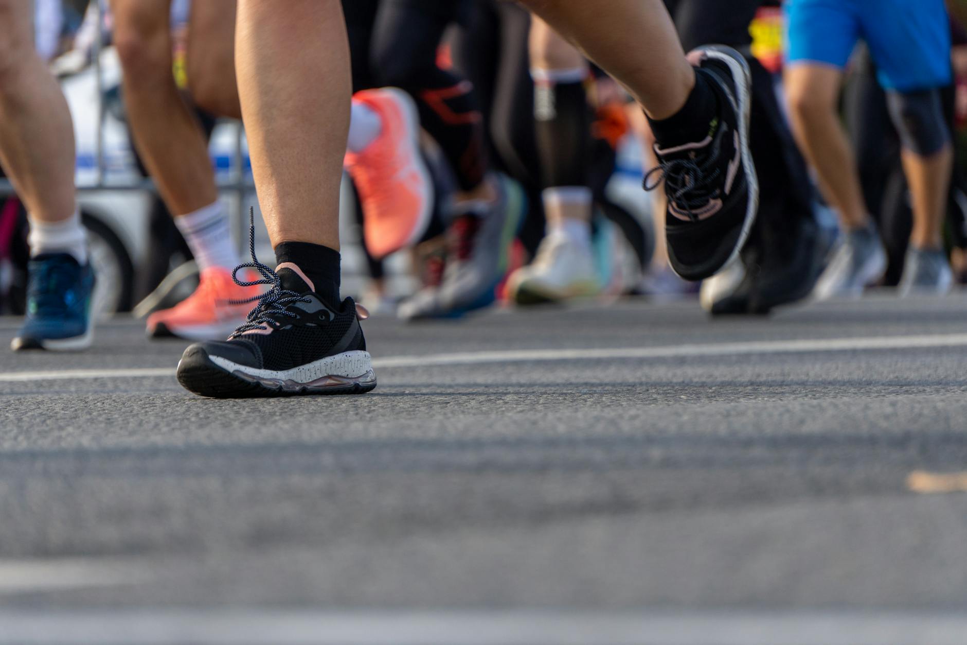
If you like to track your running and live in a large city, you could try to run every street:

Photo by Andrew Durkin on Pexels.com

What began as a means for Barbosa to get his muscles moving following an injury has since grown into a year-plus pursuit, spurred on by the 25-year-old’s inclination to get to know more of the city after moving to the area more than three years ago.

As of the year’s end, Barbosa had just over 79% of Chicago’s more than 4,000 miles of street covered. He plans to finish by the spring, then eventually move on to other cities and repeat the venture on a new maze of streets…

He isn’t the only one. For years, from coast to coast, “run-every-streeters” have been taking on their version of the challenge, turning their metropolitan areas into bona fide treadmills. In 2018, a man ran every street in San Francisco over a span of 46 days. A couple years ago, another runner spent the better part of 12 months jogging every street in Manhattan, a 750-mile endeavor…

But he does like to expand his horizons. He started to use running as a means to explore new neighborhoods and the more he ran, he questioned just how much ground he was covering. Barbosa found an app to track his progress and when he saw there was a leaderboard of others doing the same, with the top contender hovering at about 55% of the city completed at the time, he thought, “‘I wonder if I can beat him?’” He’s been gaining traction since, both in mileage — and followers.

It would be interesting to know whether this was a thing before the ease of tracking movement via apps and GPS. It would be one thing to track running on a paper map. This is certainly doable. On the other hand, if a phone or a watch will track someone with no effort, now all the participant has to do is move. They could do their normal run or walk or bicycling and their route is captured. Their movement is quickly mapped and quantified. They just have to follow through with moving along every street.

Furthermore, they can compare their results to others. A leaderboard is referenced above. Does this mean the app or tracker is providing every street/mile as a goal? This is another step toward more people covering every street: their movement is tracked but it can become a competition to meet this goal. There will be a winner!

Any runner want to take on every mile in cities with more square miles than Chicago, like Nashville or Jacksonville or Juneau?

Avoiding the weather with walking that weaves in and out of buildings

In the last two decades, I have had occasions to give walking tours of places. This can require weaving in and our of buildings in order to get out of inclement weather. Whether trying to get out the rain or snow or cold weather, a walk that combines moving outside and inside can be very helpful.

Photo by Vlada Karpovich on Pexels.com

The problem is this: most places are not set up for this. The typical American building is oriented toward the street. You go into the building from a sidewalk or a parking lot and then you exit the same way. It can be difficult to find a pathway across buildings when there is not an easy pathway between them nor multiple entrances and exits to use.

College campuses offer a few more possibilities. These buildings are sometimes oriented toward a street but they are sometimes oriented toward a quad or a path. They often have multiple entry points. And visitors to a campus might be interested to see the interiors of certain buildings; what do classrooms look like? What is in social spaces for students? Where are different important offices and services located?

I found my own paths through campuses and the suburb in which I live. There are ways to take advantage of buildings, awnings, overhangs, and public spaces. It does not always work – I was recently caught in a torrential downpour where my umbrella did little good – but there are options if one is looking.

(Of course, there are cities and places that do offer interior walkways. Take downtown Minneapolis with a series of above ground walkways between buildings or the Pedway in Chicago. In places with consistently unpleasant weather, there need to be consistent options. Shopping malls are all about this as well; lots of walking possibilities once you drive to the mall.)

Trying to cut through a street grid on a diagonal to save time and distance

Street grids have benefits, including offering multiple routes should congestion arise at one intersection or certain routes are off-limits. But what if a driver or pedestrian wants to move quickly through the grid at a diagonal?

Photo by Pixabay on Pexels.com

Different communities may offer options for this. Perhaps there are alleys one can cut through. These back ways offer even more alternatives through the grid if the main streets are congested. Or there might be an occasional diagonal roadway that crosses at an angle to other roads. Depending on the way one is traveling, the diagonal route might be more direct.

Chicago is a good example of having both options in numerous neighborhoods. The flat Midwestern city primarily has a road grid that stretches for miles. East-west and north-south streets can go a long way from one end of the city to the other (and beyond). At the same time, alleys and diagonal streets provide other travel options. The diagonal roadways can create some interesting intersections – these present travelers with different visuals and traffic patterns than they might be used to – but offer more direct routes at an angle to the grid. Numerous alleys take some pressure off the roads for garages, garbage, and other uses.

I imagine other places might offer different options. Any city offer an underground grid at a 45 degree angle to the ground-level grid? Or pedestrian skyways or tunnels that offer paths that cross the grid in different ways?

The culture wars come for traffic policies

Should motorists or others take precedence on streets and roadways? Legislative battles over traffic policy in Washington, D.C. show how this has become a culture war issue:

Photo by Sora Shimazaki on Pexels.com

One of the proposals would forbid Washington’s local government from banning right turns at red lights. Another would do away with the automated traffic-enforcement cameras that ticket D.C. drivers for speeding, blowing stop signs and other violations.

The provisions are not just a case of earnest traffic-engineering wonkery sneaking into Congressional oversight. They represent a culture-war cause just as real as D.C.’s needle-exchange efforts or mask mandates, two other targets of current GOP riders. At the core of it is the politically revealing question of cars versus other ways of getting around.

In blue cities across the country, local road policy in the past decade has been tweaked in the name of making things safer and more enticing for non-drivers — often by making things slower and more annoying for motorists…

In a polarized country, it was inevitable that this would become more than just a disagreement over traffic circulation and moving violations. After all, the 21st century push to promote alternative modes of transportation cites a Democratic-coded cause (climate change) to promote ways of getting around (by foot, bike, bus, or subway) that are a lot more convenient in dense blue cities.

On the right, for more than a decade, there’s been a refrain about the “war on cars” right alongside the war on Christmas. “There is a loud constituency that does not want you to drive your car,” said Jay Beeber, executive director for policy at the National Motorists Association, which has championed the measures dictating Washington policy. “A lot of this is virtue signaling.”

Four thoughts:

  1. Is it “inevitable” that this would become a culture war issue? I am sure there is an interesting history in here. Does this go back to seat belt laws? Speed limits on highways set in the 1970s?
  2. It is relatively easy to break this down into cities versus other areas. What about groups or political discussions in between such as suburbs promoting more walkability and bicycling, small towns and rural areas trying to lessen dependence on cars, and regions emphasizing different transportation policies? Are there Republicans for different road policies and Democrats for more driving?
  3. The interplay between federal and local policies is worth paying attention to. Americans tend to like local government oversight of local issues. Do Americans tend to think the federal government does too much regarding traffic policies or not enough?
  4. Where does this issue rank in the range of culture war issues? Is this more like a proxy war or the big issue? Americans like driving so this could get at core concerns about American ways of life.

Why there might not be a walkway between apartments and a grocery store

A Reddit post discusses the lack of a walkway between a Florida apartment complex and a grocery store. Instead of a short walk between the two sites, people have to follow a roadway roughly half a mile. Why might this be the case?

Photo by Flo Dnd on Pexels.com

Here are several possible reasons:

  1. Planning in the United States tends to emphasize driving. This shows up in many ways over many decades and in many places.
  2. Perhaps the store and the apartment are part of separate developments constructed at separate times. Building them at the same time may have presented an opportunity to provide a linking walkway.
  3. Could it be a question of who would pay for the walkway and who would pay to maintain it?
  4. Has there been local public support for a walkway? Debate at local government meetings? Has the question been raised repeatedly?

Americans tend to at the official levels and in individual choices promote driving. Many developments in the United States, particularly in suburbia, rely on driving. It can require working against the grain to promote other modes of transportation, including walking.

Humans walk, Americans drive

One feature of human beings is that they move on two legs. This bipedalism provides a primary means of locomotion. It may have given rise to rhythm and music.

“Walking Man II” by Alberto Giacometti at the Art Institute of Chicago

Many spaces in the United States privilege driving rather than walking. Driving is often faster. In the same amount of time, a driver can likely go farther than a pedestrian.

But, driving is not what humans have done throughout most of history. Driving is much faster. It requires technology to make and maintain vehicles. There needs to a lot of infrastructure to support driving. The scale changes as a vehicle is moving much faster and needs more room.

Even to see the statue above, many visitors will take a vehicle on a roadway. This enables millions to visit the museum and take in this image. Yet, they will contemplate a depiction of a human walking while primarily traveling via other modes.

Asking Americans to not drive as much or at all is a tall order. Cars are an integral part of the American way of life. Maybe reflecting on “Walking Man II” can help people remember a past and envision a different future.

The pedestrians’ school of defensive (and hopefully enjoyable) walking

Walking is good for you and can contribute to health and sociability. Walking can also be dangerous, particularly in the United States where life is optimized for those in cars and trucks. Given this context plus my own experiences walking, here are my rules for the pedestrian:

Photo by Uriel Mont on Pexels.com

-Always be aware of your surroundings. Do not walk distracted to the point where you do not know what is going on.

-Take in and enjoy what is going on around you involving people, buildings, nature, and more.

-Keep at the speed of other pedestrians around you. There are times to go slower (strolling areas, tourist areas) and times to go faster (going with rush hour traffic to the train station). Know the purpose of your walk and act accordingly.

-Do not stop suddenly in the middle of walking.

-Do not block the middle of a walking path.

-Anticipate the actions of others, particularly vehicles.

-Be clear and decisive in your movements. Do not make others guess at your intentions as a pedestrians.

-Make eye contact with drivers.

-If walking in a space shared with vehicles, walk against traffic and stay to the side.

In roughly two hundred years, humans have gone from primarily walking to traveling much faster speeds on a regular basis. Let us not completely lose our walking skills and enjoyment.

From the “walking cities” of 1815 to the sprawling cities of today

In recently teaching about the development of the American suburbs, I was reminded of the description of “walking cities” in 1815 provided by historian Kenneth Jackson makes in Crabgrass Frontier:

Photo by Ryutaro Tsukata on Pexels.com

The first important characteristic of the walking city was congestion. When Queen Victoria was born in 1819, London had about 800,000 residents and was the largest city on earth. Yet an individual could easily walk the three miles from Paddington, Kensington, Hammersmith, and Fulham, then on the very edges of the city, to the center in only two hours. In Liverpool, Birmingham, Manchester, and Glasgow, the area of new building was not even two miles from city hall. (14)

While the focus here is on congestion, the time it takes to walk through such density in a major city is notable: in a few hours, one could traverse a significant portion of the city.

Introduce technology with more speed – trains, streetcars, cars, etc. – and cities could expand in space. People could live further from work (the proximity of home to work for many is a feature of the 1815 city that Jackson also notes). The city could go on for miles. The suburbs could extend even further. But, the ability to see a significant portion of the city in a single walk became much harder.

In a society devoted to driving and business, what alternatives are there to rental cars?

The rental car industry has had a difficult year, customers are unhappy, and some companies are still making money. In a country that likes driving, has planned around driving, and has oodles of cars plus encourages business activity, what could be done to not depend on rental cars? A few options:

Photo by Tim Samuel on Pexels.com
  1. Car sharing services. There are more of these around today. Cut out the middle-man business and just deal with a private car owner for your transportation.
  2. Taxis and/or ride share companies. These are more available in some places than others and do not allow the same freedom as being able to drive a rental car wherever and whenever you would like.
  3. Public transportation. Even less available outside of denser urban areas. And even in places where mass transit is plentiful, many people still opt for private vehicles.
  4. Walking or bicycling. Very difficult and possibly dangerous in many locations.
  5. Borrowing a car from family or friends or doing without it for a time. It could be done but the location and time frame is very important.

Thinking back, I can recall multiple trips where a rental car was a necessity in order to get where we wanted to go. At the same time, some work trips did not require a vehicle because the location of the meeting was in a large city with public transit options. And if you are in a suburban or more rural setting and your car is in the shop for more than a day, a car rental may be very necessary.

Does this mean Americans must put up with rental cars forever? Perhaps someday there will be fleets of electric vehicles for all to access. Until then, renting a car may be a necessary evil.

What I can access in a 10 minute drive from my suburban location

Following up on an earlier post this week on the desire some Americans have to live within 10 minutes drive from what they need on a daily basis, I briefly catalogued what I could access within ten minutes drive of my suburban residence. Ten minutes does not necessarily get my very far from my house given residential speed limits and the number of stop signs and traffic lights in my way. For most of these locations, I can access them by bicycle in about the same time (though I cannot carry as much).

Photo by UnknownNFT on Pexels.com

Here is a rough count of what is within 10 minutes:

Grocery stores: at least 5

Gas stations: at least 3

Fast food/fast casual restaurants: at least a dozen

Parks: at least 5 community parks, two forest preserves, one linear pathway

Schools: at least 4

Other shopping: one second-tier shopping area at a major intersection, multiple strip malls, lots of car repair and automotive parts places, etc.

Transportation: 1 commuter train station

Almost 10 minutes away (usually more like a 12-15 minute drive away): 1 suburban downtown with a public library, local stores and restaurants, civic buildings; 2 interstates; many more stores/schools/parks; multiple big box retailers

All of this within a residential part of suburbia with medium levels of suburban density. The people around me could walk or bike to many of these locations but many do not since a short drive is convenient and normal. I would guess many residents would say the quick driving access to so many amenities is a contributor to the high quality of life.