It suddenly struck me that that tiny pea, pretty and blue, was the Earth. I put up my thumb and shut one eye, and my thumb blotted out the planet Earth. I didn’t feel like a giant. I felt very, very small
The closest I have come to that is a view like this:
This was my view from an airplane window on a recent trip. The landscape is not particularly special (no big mountains, no big cities, no big bodies of water, etc.) nor is the sky or atmosphere particularly noteworthy (it was cloudless and in the afternoon).
Yet, I enjoy looking out the window every time. To be able to fly thousands of feet above the ground and see it from this angle is exciting. A map can provide an overview from an above perspective but this is not the same as looking at the landscape as it moves below you.
From the ground, planes look very small flying through the air. But the view from the plane makes the landscape as a whole look big as it trails off to the horizon. I do not think I could get tired of this perspective from above and adding it to the very human experiences we all have rooted firmly to the ground.
San Miguel Chapel is the oldest Catholic Church built in the United States part of whose original walls are still standing and which is still used regularly for religious services. It is the centerpiece of El Barrio de Analco National Register Historic District in Santa Fe, New Mexico. Adobe buildings like this chapel, historically, were not exclusively used for worship and ceremonies. Their size and location within the community allowed for a variety of gatherings.
During the 400+ years, first under the rule of imperial Spain, then Mexico, and finally the USA, the Chapel, dedicated to Archangel Michael, has been many things to many people. It has served as a place of worship for diverse groups of Native Americans; an infirmary for Franciscan missionaries; a target for autocratic officials and exploited Pueblo groups; a military chapel; a unique venue for talks, concerts, celebrations and ceremonies; and a sanctified space for Sunday Mass in Latin and English. Today and into the future, this treasured, privately owned, but ever-fragile structure requires constant vigilance and expert use of traditional construction methods and culturally authentic materials.
San Miguel Chapel first appears in the surviving historical written record in 1628. Construction my have begun by 1610 according to oral history, simultaneous with, or prior to, the official founding of Santa Fe. According to archeologists, this Franciscan-designed house of worship rests upon an early Pueblo settlement from circa 800-1300 CE.
The Importance of Oral Tradition: Few question whether or not the San Miguel Chapel in Santa Fe is the oldest Church in The United Staes, but many do question just how old it is. It’s no easy task to sift historical fact from traditional belief. Oral history holds that San Miguel Chapel was built around 1610, and it has been rebuilt and restored several times over the past 400 years. Oral tradition, stories told throughout the generations by local families and communities, remains a binding fabric of identity and historic pride for local people.
Official documentation stored in the Chapel was destroyed by fire during the revolt of 1680. However, many documents had previously been sent back to Mexico and Spain as reports to officials. Even today, documents naming San Miguel Chapel are being discovered all over the world, the latest one in London.
This might be a surprise for those oriented to a history of the United States oriented more to the East Coast or English settlement patterns or Protestant history in the US.
Additionally, this means the congregation and a building have been present for over 400 years, a large amount of years for a country often interested in youth and breaking away from older European patterns.
Finally, the building has been part of colonial activity, beginning with Spanish activity with Indigenous people to the aftermath of the Mexican-American war when the United States took control over land ceded to it.
Persistently high home prices and elevated mortgage rates are keeping potential home buyers on the sidelines. Sales of previously owned homes in the first nine months of the year were lower than the same period last year, the National Association of Realtors said Wednesday.
Existing-home sales in September fell 1% from the prior month to a seasonally adjusted annual rate of 3.84 million, NAR said, the lowest monthly rate since October 2010. Economists surveyed by The Wall Street Journal had estimated a monthly decrease of 0.5%.
Three quick thoughts in response:
The article hints at the consequences of this low level of sales. The mortgage industry is not originating as many mortgages. Potential homebuyers do not have as many options to choose from and the prices are higher. Not mentioned: does this mean this is helping to keep home values high? Or how much less economic activity does this all add up to?
Why are home sales measured in absolute numbers? Compared to 1995, I assume there are more potential homes that could be sold in the United States because there are more homes. If we looked at the percentage of existing homes sold, wouldn’t the lower activity even be more clear?
The expectation in this article and elsewhere seems to be that home sales should be at a higher level or should be growing in number. How cyclical are these numbers? How realistic is it to expect ongoing growth in this area? Looking at the chart in the article going back to 1981, it looks like there are 3 rises in growth followed by periods of lower numbers.
By itself, I am not sure what this particular figure compared to change over time means. What happens in the long run if the trend continues or it does not?
One of AI’s hallmarks is its ability to learn and digest enormous amounts of information. Property data is readily available to the public, and in some states, a simple search can unearth appraisal data, blueprints, transaction records, and even pictures of executed deeds. With AI, fake documents could be created faster and more realistic-looking.
“They’re just creating these AI models that are reading all of the public records and public data that they can possibly get their hands on, that are then creating a means by which they can manipulate that information,” Adams said. “So it’s like the ingestion is now automated because of AI models, and then the impersonation is a lot more sophisticated.”
An AI tool might be able to recognize a vacant property in a database faster than a human could or identify homes without mortgages attached to them (which could mark them as targets for a refinancing scheme).
The amount of personal information available to fraudsters also makes impersonation easier.
Kiar said his office has handled hundreds of fraud cases. Only two of those cases so far have involved AI, but he remains concerned that more are on the way.
Public databases have numerous advantages. People can search information more quickly. Processes can be automated. Local governments can demonstrate transparency. Researchers can access information.
But this story hints at the down sides. Anyone – or any system – could access the information. Those with malicious intent might be able to make something of the information intended to serve the public good.
The article suggests a need for verifying the identity for those filing a deed. Two-factor authentication for local government transactions! Could such verification require non-online actions, thus negating some of the advantages of online transactions?
Golf Mill Shopping Center opened in 1960 as an open-air mall. Later, it was enclosed, and the iconic Mill Run Playhouse was built on the grounds. The theater, before it closed in 1984, hosted acts such as Chicago native Shecky Greene and Frank Sinatra.
Today, the mall has more than 1 million square feet of leasable space in addition to a nine-story office tower. Target and JCPenney are two of its biggest anchors, alongside AMC Theatres, Ulta, Burlington and Ross…
Alpogianis and other city officials see the future of the 80-acre site as “live, work, play” — an increasingly popular phrase for mixed-use developments that have virtually everything a resident could need on site. The Golf Mill Shopping Center redevelopment — to be called Golf Mill Town Center — will aim to be one of Niles’ premier destinations in the absence of a traditional downtown.
The first phase of redevelopment will include an overhaul of the mall’s retail, along with new luxury apartments and restaurants, Alpogianis said.
He said the project will be 70% retail and entertainment and 30% residential and other uses — the latter of which includes the “very good” possibility of a hotel and office, depending on market conditions.
The shopping mall redevelopment described here is common these days: add housing, restaurants, and different retail options to what was a mall with declining activity and revenue. The goal is more of a 24 hour a day place where a combination of residential, commercial, and recreational activity makes it more like a lively neighborhood.
What struck me here was the idea that such a redevelopment could help address a different issue in the suburb: no traditional downtown. In the Chicago area, such a downtown would typically be located along a railroad line connecting suburbs to downtown. Niles is more of in-between two railroad lines and the community had a small population until a population explosion in the 1950s (over 400% growth).
While the shopping mall is often viewed as a postwar substitute for public space, could all of these mall redevelopments lead to new suburban downtowns? The mixed-use developments are often intended to be more walkable, at least to the new residents who live there, and provide social spaces. Whether this actually happens is another matter; will the redeveloped malls be connected to a larger walkable grid in suburbia? Will people still need to drive to the redevelopment? Once people are living on site, how many will regularly make use of the nearby amenities as opposed to driving elsewhere?
The shopping mall may come and go in many suburbs but the quest for something like a downtown may continue.
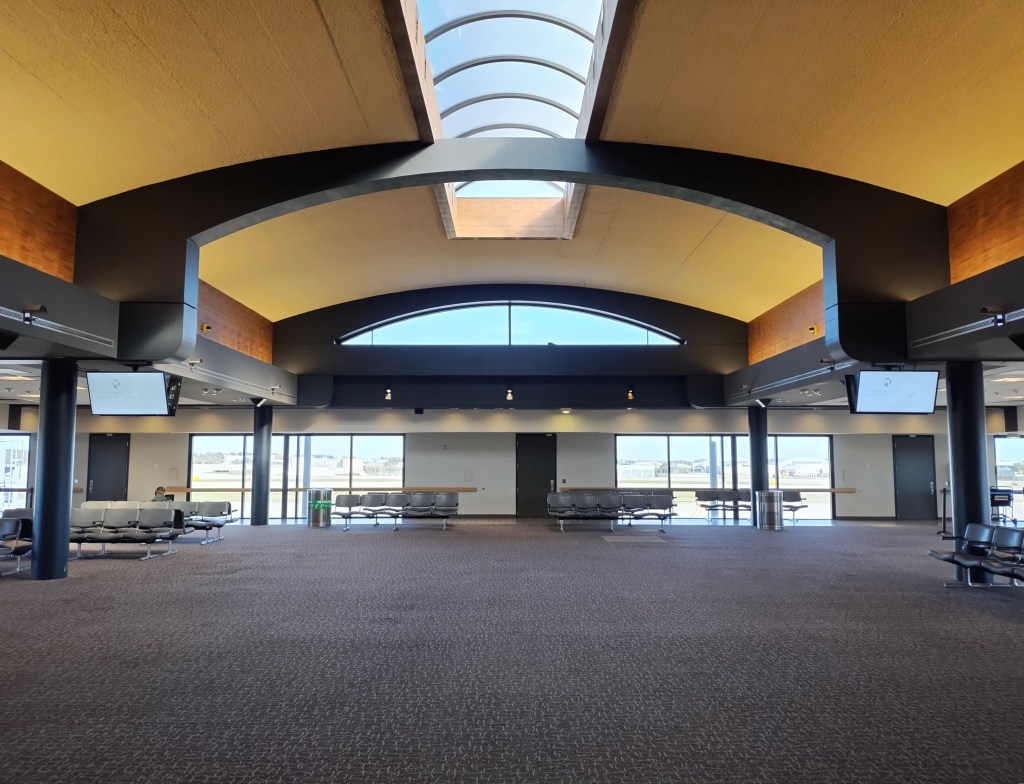
With time to spare on a recent trip, I walked all the way to the end of the airport:
This is both what I expected to find and not what I expected to find. On one hand, there are few spaces that look quite like an airport. The big open space surrounded by banks of chairs, a particular kind of carpet, and plenty of windows to see outside interspersed with a lot of doors no one can enter unless they are officially open.
On the other hand, there was no one at the end of the airport. Well, one person on the left taking advantage of the relative solitude. No planes waiting at this area and actually no used gates even near the end. This is not what I commonly see in the two Chicago airports where it seems the opposite issue is present: there are not enough gates for all the flights and airlines and some people have to wait on a tarmac.
Depending on your point of view, this might be an oasis or an opportunity or a waste of resources. Could this provide a refuge from the hustle of the airport near the center where all the concourses branch out? Could the airport do with fewer gates, thus leading to lower costs for maintenance and staff? Or might this lead to a future of more flights with room to grow? Is this space best experienced when filled with activity and travel?
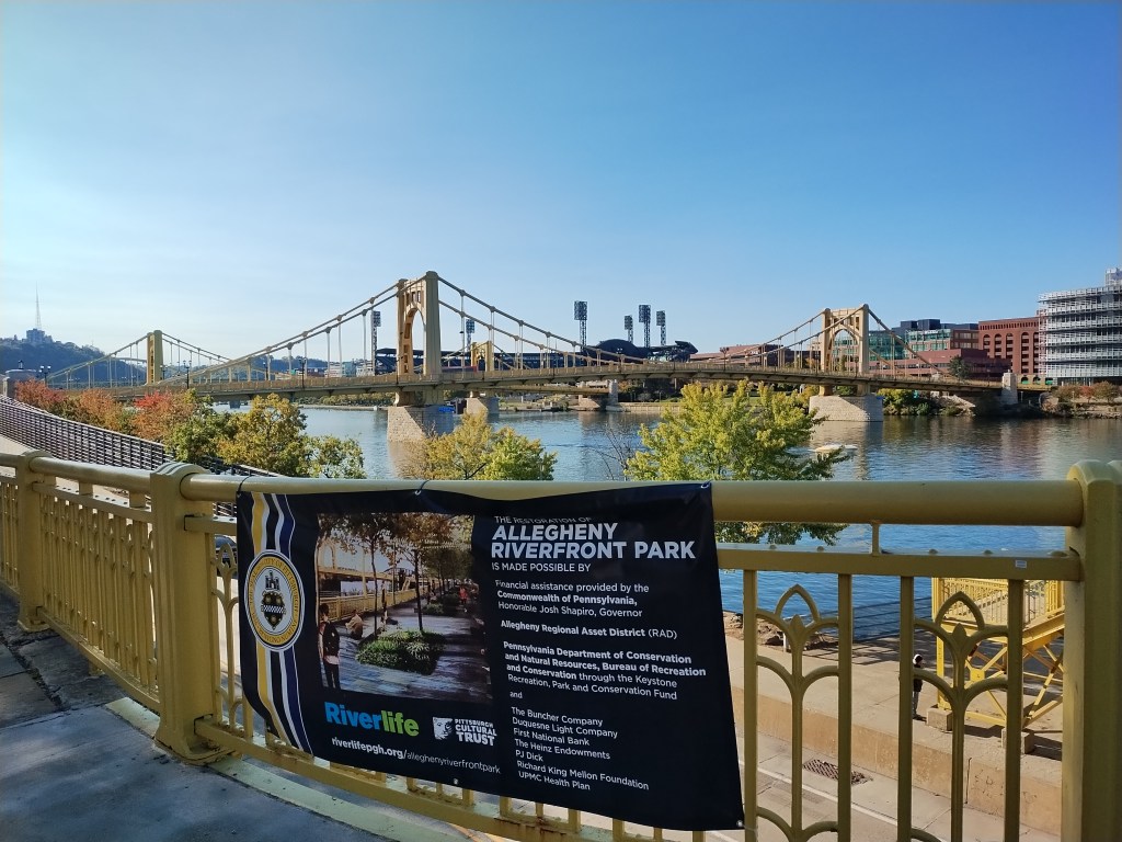
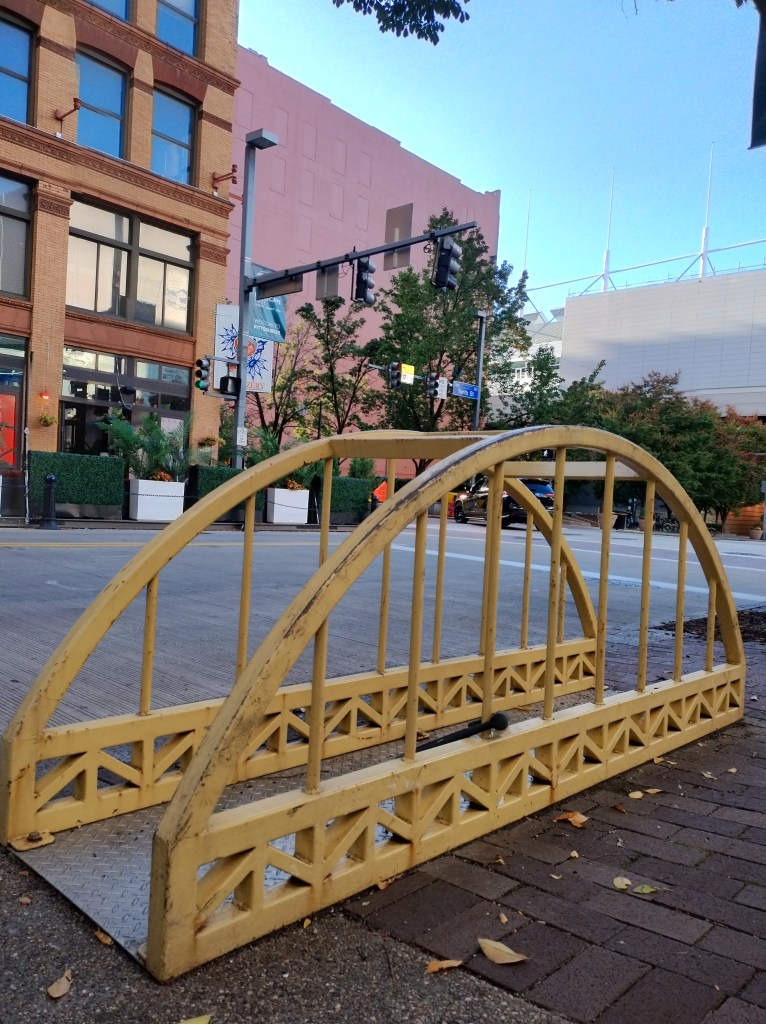
According to a few sources (here and here), Pittsburgh might claim the most bridges in the United States. Other people disagree (such as here).
All communities have features that they regard as unique or noteworthy. Bridges are an interesting choice: beyond having a lot of them, they are easy to see and are necessary for transportation.
Like in many matters, it may depend on measurement for claiming this civic title: what counts as a bridge?
Noisy mufflers were among the top complaints at a recent “chat with the chief,” and city council members also have fielded complaints coming from the downtown district and the south end of Naperville near 95th Street.
The noise from engines revving and modified mufflers can get loud enough to be heard blocks away, said Mayor Scott Wehrli, who lives near the city’s downtown district. This summer, for example, motorcycles revving their engines through one of the parking decks created enough noise to disrupt an outdoor summer band concert, he added…
Under state law, it is illegal to have a modified muffler on a vehicle, Naperville Police Chief Jason Arres said. Naperville police have been issuing citations based on that law.
Between Sept. 1 and Oct. 8, police issued 26 citations. Two of them resulted in guilty pleas on Wednesday and about $300 in fines for each citation, officials said…
Arres, who noted complaints about noisy cars is not unique to Naperville, is hopeful word will travel fast that loud cars aren’t welcome in town.
Two questions quickly came to mind when I read this:
Will loud cars and vehicles now avoid Naperville? It is a big community with lots of locations for locals and visitors to travel to.
What if nearby suburbs do not enforce this state law? Say Naperville continues to enforce this law and issue citations and some of the drivers do indeed stay away; will these drivers simply visit nearby suburbs? Will they get their vehicles fixed or modified? While Naperville is indeed big, nearby suburbs could many of the same kinds of places to drive to.
This is not just limited to loud cars; what about enforcing having proper license plates or tinted windows that are too dark or other vehicle issues that are not moving violations? If a number of communities do not enforce this, will it make that much of a difference?
It will take some time to see if the issue is addressed to the satisfaction of Naperville leaders and residents. And will the problem shift to neighboring suburbs?
Widely shared on social media, the atmospheric black and white shots — a mother and her child starving in the Great Depression; an exhausted soldier in the Vietnam war — may look at first like real historic documents.
But they were created by artificial intelligence, and researchers fear they are muddying the waters of real history…
For now, Amaral and Teeuwissen believe they can still tell fake historical images from real ones just by looking at them.
AI-generated photos often have tell-tale glitches: too many fingers on a hand, missing details — such as the lack of a propeller on the Wright brothers’ plane — or, on the other hand, compositions that are too perfect.
“AI-generated pictures can recreate the look, but they miss the human element, the intent, the reason behind the photographer’s choices,” said Amaral.
With AI text and images, history could be all redone. What is available online, often the first or primary source for many, could provide different historical accounts and evidence.
Of course, history to some degree is always in flux as different actors and different contexts affect how we understand what happened in the past. There are things that happened and then perceptions and interpretations of those happenings that often take time to develop and solidify. AI joins an already existing process.
Do AI images then pose a unique threat to historical knowledge and narratives? If history is primarily created and understood through images online, perhaps. Will others find ways to demonstrate that certain images are truly from the past?
As more actors express concerns about how social media use affecting the mental health of “children and teens,” this article suggests it can be hard to directly measure this link:
It doesn’t help that mental health is influenced by many factors, and no single treatment works for every person. “It’s not as straightforward as: What is the right antibiotic for that ear infection?” said Megan Moreno, a scientist and pediatrician at the University of Wisconsin-Madison, and co-director of the Center of Excellence on Social Media and Youth Mental Health at the American Academy of Pediatrics…
Among the reasons that make it difficult to isolate the role of social media in kids’ mental health is that the relationship between mental health and tech use is a two-way street, the panel from the National Academies of Sciences, Engineering, and Medicine said. A person’s mental state might influence how he or she uses the platform, which in turn affects his or her state of mind.
Randomized, controlled studies on whether social media caused the mental-health crisis are impractical because exposure to social media is now everywhere, researchers say. In addition, platforms are constantly changing their features, hobbling efforts to run long-term studies, they say.
A decade ago, Munmun De Choudhury, a computer scientist at Georgia Tech, was part of a team that showed that groups promoting disordered eating were skirting Instagram’s moderation efforts. De Choudhury says that such studies probably would be impossible today because social-media companies no longer allow access to public data, or charge hefty fees for it…
Research into the roots of distress in young people has found that other factors—bullying, or lack of family support—have stronger associations with mental-health outcomes, compared with social-media use.
These are different issues. This includes having access to data from platforms as well as data over time. Additionally, it takes work to separate out different influences on mental health. Randomized controlled trials that could help with this are difficult to put together in this situation. Other factors are shown to influence mental health.
Some think there is enough data to make the argument about social media use influencing mental health. For example, social psychologist Jonathan Haidt puts together evidence in his latest book The Anxious Generation. His approach is one that social scientists can take: there seem to be consistent patterns over time and other factors do not seem to account as well for the outcomes observed. And if there is a growing consensus across studies and scholars, this is another way for scientific findings to advance.
This is an ongoing situation as policy efforts and research efforts follow sometimes intertwining paths. If a state restricts social media use for teenagers and then mental health issues drop, would this count as evidence for social media causing mental health distress?