The limited safety of pedestrians and bicyclists even in quiet residential neighborhoods

Street and intersections in quiet suburban subdivisions are not necessarily designed with the safety of pedestrians and bicyclists in mind:

Photo by Jeswin Thomas on Pexels.com

The station reached out to county officials and the local police precinct; everyone sure scratched their heads about that one. There was supposed to be a stop sign there, said the county, and they didn’t know why there wasn’t one installed. The police made sure to point out that it wasn’t their fault, either, because, they said, residents hadn’t complained. “Some residents have now reached out to us requesting additional signage,” said the precinct’s commissioner, James Mett. “In the coming days, we plan to examine and research the issue to determine the best course of action moving forward.” A few phone calls later, it was announced that a new stop sign would be installed Thursday.

So, that’s one thing that made this street unsafe. But there are plenty of other problems, not unique to this intersection but common to many, many American streets, that also made it unsafe. There’s no signage of any kind to alert drivers to the possibility that walkers or cyclists might want to cross. There are no traffic-calming design elements, like speed bumps, raised crosswalks (or any kind of crosswalk), or extended curbs. There’s no protected bike lane.

The speed limit on this road is 30 miles per hour, as it is on roads in all Texas cities. Last year a Texas lawmaker introduced a bill to lower the speed limit on such roads to 25 miles per hour. Cars traveling 30 miles per hour are 43 percent more likely to kill pedestrians they hit than cars traveling 25 miles per hour, according to the AAA Foundation for Traffic Safety. This is the lawmaker’s third attempt to pass this bill, and it seems to have been just as successful as the first two times, as nothing has happened to the bill in more than a year. (We don’t know how fast the driver of the Hyundai was traveling. Maybe she was going less than 30 miles per hour. Or maybe she was going faster; after all, Google Street View suggests you can drive the entire length of Kings Mill Road, a circuit of nearly a mile, and never see a single speed limit sign.)

And notably, the driver who struck and killed Chase Delarios was driving a midsize SUV. The heavier the car, the more likely it is to kill a person if it strikes them. At between 3,500 and 5,000 pounds (depending on specific model), a 2017 Hyundai Santa Fe is more than a match for an 8-year-old and his bike. (The post-crash local news coverage shows the bike, horribly, jammed under the Hyundai’s rear wheel.)

And the conclusion:

Like most American streets, Kings Mill Road is not a safe area for pedestrians or people riding bikes. It’s designed for drivers, and drivers use it that way. That’s the system we’re trapped in…

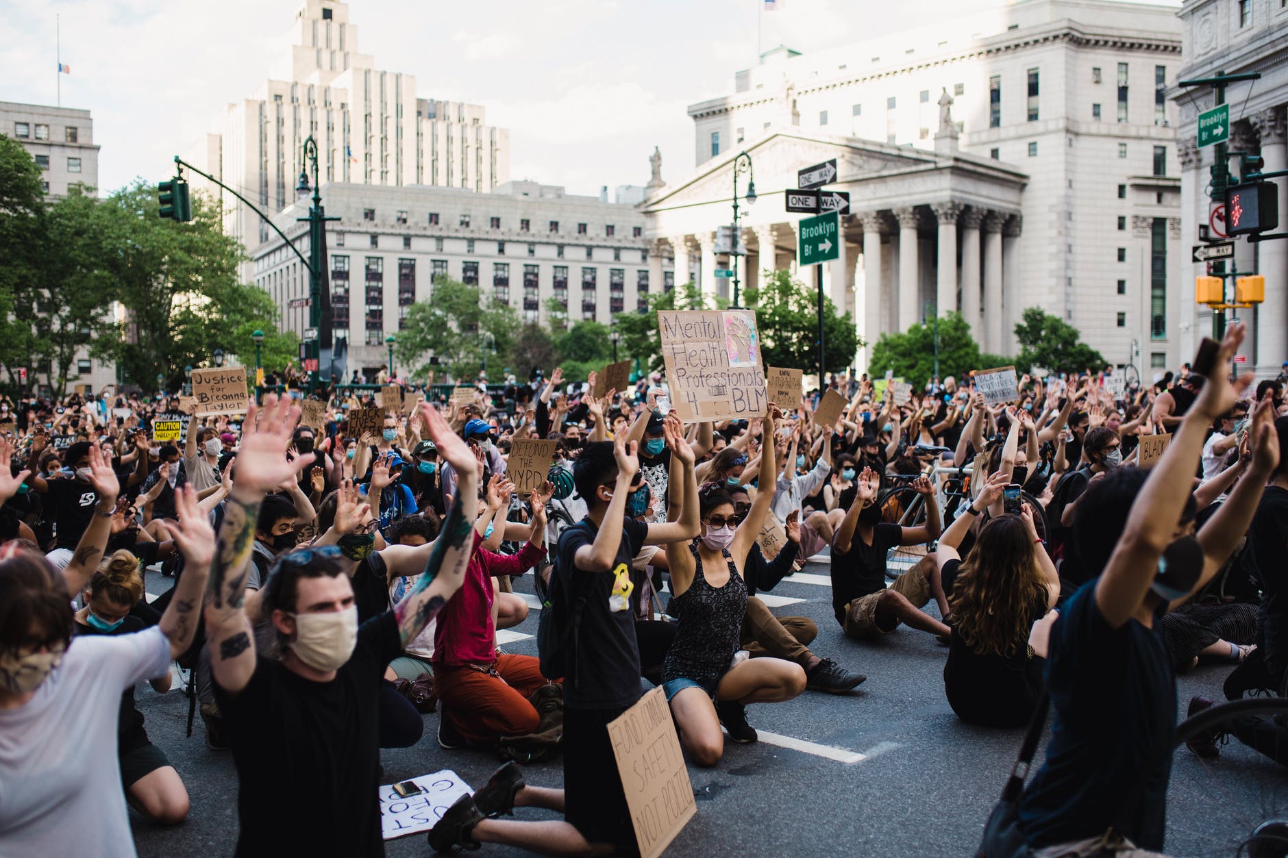
In the United States, cars and vehicles with engines rule the roads. We have built whole systems and ways of life to accommodate them and ease their travel. It is supported by public and private money, public sentiment, and an ongoing series of decisions.

If you are traveling via other means, you have to be aware and careful. Know where vehicles are at all times. Be cautious in crossing, even at clearly marked walkways. Be ready to move quickly if needed. Make yourself visible to vehicles.

To change this or seriously address this would require a long-term effort to redesign basic aspects of everyday American life. It can be done, but a sustained series of actions is difficult to organize and execute.

I missed the urban scooter revolution

On a recent trip to Los Angeles, I saw a part of urban life I primarily read about: the proliferation of electric scooters.

The scooters were all over the place. There were more scooter users in the bike lanes than bicycles. Scooters of multiple services zoomed by. They could be parked anywhere.

They make a lot of sense in a place with good weather, limited mass transit, and a good number of visitors. (On the other hand, they do not make as much sense right next to the large vehicles Americans often drive.)

One additional thought: are these scooters doing what the Segway was supposed to do or could have done?

A freight train through the center of town

At-grade railroad crossings present dangers. But, what if the freight line runs right down the middle of a road through the center of town? This is LaGrange, Kentucky:

More images here and here.

This is an unusual situation but it hints at the intertwining of trains and communities. This would be a strong reminder of the goods moving across the landscape and how it intersects with traffic, pedestrians, buildings, and residents. Many might prefer that freight just shows up where it needs to – usually at the point of use or access by consumers – but it has to come from and to somewhere first.

Now I wonder how many American communities have this particular situation. This might be more common in big cities or in cities in other countries where mass transit lines run on roadways. Or, this could encourage remembrances of the extensive streetcar systems in many American communities that utilized local roadways.

Many goods come via truck, few want to encounter those trucks on a suburban road

Trucking is essential to the American economy. However, it is not desirable to encounter many trucks on local roads. Here is how one Chicago area county wants to address the issue:

Photo by Craig Adderley on Pexels.com

“The key is really getting trucks onto the interstate as safely and efficiently as possible,” said Patricia Mangano, senior transportation planner with the Chicago Metropolitan Agency for Planning.

As the county grows and the region continues to be an important national transportation hub, the study recommends strategies to minimize the negative impact of freight traffic to residents and the environment…

The report says that high volumes of truck traffic have led to safety and congestion concerns, especially in sensitive areas such as historic districts, neighborhoods or environmentally protected areas. The study notes western Will County’s natural and cultural assets, such as Midewin National Tallgrass Prairie, Abraham Lincoln National Cemetery and the Kankakee River, could be negatively affected by new development and traffic…

“We are the proverbial crossroads of America,” he said, noting residents just want to ensure they can get from work to home to their children’s activities without being caught in traffic.

In recent decades, Will County has become home to an increasing number of warehouses and intermodal facilities. This could be viewed as a positive for economic activity and growth which then leads to more tax revenues, jobs, and prestige.

Yet, certain industries do not necessarily mesh well with the suburban single-family home ideal. Trucks are related to a number of concerns residents have about all sorts of land uses: noise, traffic, lights, threats to the residential ideal they hope for.

I see the point of routing truck traffic along particular roads. This also has the effect of altering those roads. I can think of several major thoroughfares near here that are full of truck traffic during the day. Driving on these roads can be quite different than driving on other main roads. And because the way many suburban communities are laid out, there are often not good alternative routes since traffic in general is funneled from smaller residential streets to larger volume roads.

An impractical suggestion that might please suburban residents: have truck only roads that lead from industrial and commercial properties straight to highways. In many locations, this might work as warehouses and distribution centers are clustered together as are big box stores and shopping malls. On suburban roads without big trucks, suburbanites might occasionally find the opportunity to drive like people do in car commercials: on the open road.

The ongoing tactic of social movements blocking roads

I saw news earlier this week about efforts by climate activists in Germany to draw attention to their cause:

Photo by Life Matters on Pexels.com

Climate activists on Wednesday blocked roads leading to Germany’s three biggest airports, gluing themselves to the ground before police arrived.

Members of the group Uprising of the Last Generation said they wanted to disrupt cargo and passenger traffic at the airports in Frankfurt, Munich and Berlin.

The group has demanded that the government take measures to end food waste. It argues that throwing away vast amounts of usable food contributes to hunger and climate change.

Past protests involving the blocking of roads and ports have drawn criticism from officials across the political spectrum.

The last sentence in the portion above is telling. This particular technique draws criticism from all sides because it effectively complicates one of the most important assumptions of Western life: drivers should be able to get where they want with minimal disruption.

It may be one thing to have a crowd or protest so large that it takes over streets and roadways. It is another matter to more deliberately block main arteries and highways. Residents depend on these, truckers depend on these, emergency vehicles depend on these. Whether it is Black Lives Matters protestors or truckers in Ottawa, Canada or climate change activists, interrupting the normal flow of people and goods “works.”

I put “works” in quotes because it is less clear that this tactic leads to significant change. It may draw attention and disrupt daily life. If it angers many of the people who might align with the movement, is this helpful? Is media attention the primary focus? If governments find ways to clear roadways – and many communities have guidelines about applying for permits to hold parades/rallies/protests and this includes where these can take place – is this a win in the end?

I would not expect this tactic to go away soon.

Complicated urban repairs: 20 years to repair 11 blocks of Park Ave above and below ground

Manhattan is dense, above ground and below ground. Hence, the city is planning for a 20 year project to to a portion of Park Avenue:

Photo by Vlad Cheu021ban on Pexels.com

The good news is the city finally has plans to restore 11 blocks of Park Avenue north of Grand Central to a semblance of its former glory, Bloomberg reports, expanding the median from a useless 20 feet to a potentially-rejuvenating 48 feet. That redesigned street could include bike paths, walking paths, and generally more space for things other than cars or pretty things for people in cars to look at as they drive by.

The bad news is many if not most of the people currently living and working in New York will not be around to enjoy it once it’s done. It will take 20 years to redesign these 11 blocks, according to the city’s Department of Transportation. Yes, you read that right. The project to redesign 11 blocks of a Manhattan street will not be completed until 2042.

But there is no mistake, according to both DOT and Kaye Dyja, Powers’s spokesperson. As Dyja explained, “The reason the construction is going to take a long time is because they’re improving the underground railroads leading to Grand Central, as well as redoing the ‘train sheds.’ This entails that they’re digging up the ground, so the construction will have to take place in stages which will end up taking many years to complete.”

The project Dyja is referring to is a massive $2 billion renovation of the Metro North infrastructure underneath Park Avenue from Grand Central to 57th Street. Park Avenue is a bridge over those tracks, and like many of the U.S.’s bridges, this one is falling apart, too. The project will involve ripping up sidewalks and the median of Park Avenue a couple blocks at a time, going section by section, down the stretch of Park Avenue. It is expected to cause more or less permanent disruption to the Midtown East area, to varying degrees, over the next two decades. 

As a kid, I remember reading books with cross-sections of underground Manhattan. Seeing all of that infrastructure needed for modern urban life – pilings for skyscrapers, subways, water pipes and sewers, etc. – was fascinating.

The flip side of that is the work it takes to make significant changes to such a system. It takes time (and money) to work around what is there and complete the work.

The time is one factor but I wonder about how the budgets will work over a 20 year period. Large American infrastructure projects can have a tendency to stretch in terms of time and budget as the work is underway.

I would love to say I will check in on this in twenty years but that is a long commitment…

If mathematicians addressed traffic problems

How would mathematicians solve traffic? Here are the suggestions from a 2020 book:

Photo by Life Of Pix on Pexels.com

All drivers need to be on the same navigation system. Cars can only be efficiently rerouted if instructions come from one center hub. One navigation system rerouting some drivers does not solve traffic jams.

Parking bans. Many urban roads are too narrow and cannot be physically widened. Traffic-flow models can indicate where parking spots should be turned into lanes.

Green lanes. For cities that want to increase electric car use, special lanes should be created for electric cars, providing an incentive for their use.

Digital twins. Traffic demands and available infrastructure can only be balanced with digital modeling that creates an entire “twin” of existing roadways. The software will be “an extremely useful thought tool in the hands of transport engineers.”

I have not read the book and this description is not long but it seems to depend on both understanding current and possible traffic flows through modeling. Often, Americans typically get more lanes added to roads – which then tend to fill up because there is more capacity and/or populations continue to grow.

I wonder how modeling would fit with other values underlying road and traffic decisions. A few examples:

  1. It might be better to have a centralized traffic and navigation hub. Is this technically feasible, would all car makers want to participate, and would there be privacy concerns?
  2. The politics of providing special lanes, whether for electric cars or high occupancy vehicles or bicycles, can get interesting. Americans often think the roadway should be for all users as opposed to particular users.
  3. The road system we have is the result of not just prioritizing efficiency but a whole host of actors and forces that includes privileging single-family homes (and generally keeping them away from busy roads) and highways in and out of major cities.

Chicago truly has a grid

Looking at a map of Chicago or seeing it from above coming in and out of the local airports shows Chicago’s road network is a grid. A recent study examined just how much of a grid it is:

Photo by Benjamin Suter on Pexels.com

It is right to compare Chicago’s street network to something so obsessively exact. A recent academic study, “Urban spatial order: street network orientation, configuration, and entropy,” by Geoff Boeing, looked at the maps of 100 major world cities, and found that Chicago’s “exhibits the closest approximation of a single perfect grid.” Nowhere else have urban planners been so successful in imposing Euclidean order on natural surroundings. On a scale of 0 to 1, in which 1 is a perfect grid, Chicago scores 0.9. (The least-perfect grid is Charlotte, a Sunbelt city whose street system is more entropic than Rome or São Paulo.)

Why such a design?

The man hired to plat a town at the mouth of the Chicago River was James Thompson, a surveyor from Kaskaskia, and the father of the Chicago Grid. Illinois had already been divided into square townships and sections by the Northwest Ordinance of 1785. Since Thompson was subdividing a township section, he simply repeated that pattern in miniature when he designed Chicago’s first street map. It was less than half a square mile, bounded by Kinzie on the north, Washington on the south, Jefferson on the west and Dearborn on the east, but it was the template for a network that would eventually cover the 234 square miles of Chicago—and extend into suburbs beyond its borders…

Thompson’s grid was interrupted only by the river, and by established Native American trails which became diagonal streets: Elston, Clark, Milwaukee, Archer, Ogden. By 1869, the grid had become so integral to the city’s identity that the Tribune boasted, “There is no city where the opportunities for straight streets are so advantageous as in Chicago,” and demanded, “Give us straight, broad streets, running uninterruptedly from one extremity of the city to the other.”…

In our quest for orderliness, Chicago also has the advantage of being one of the flattest cities in the U.S., lying on a plain that was once the bottom of a proto-Great Lake. It would not be practical or possible to impose an uninterrupted grid on Pittsburgh or San Francisco, where streets wind sinuously around hills. As the study notes, “Boston features a grid in some neighborhoods like the Back Bay and South Boston, but they tend to not align with one another. Furthermore, the grids are not ubiquitous and Boston’s other streets wind in various directions, resulting from its age (old by American standards), terrain (relatively hilly), and historical annexation of various independent towns with their own pre-existing street networks.”

This sounds like a perfect storm of factors: a planner who applied methods from the Northwest Ordinance, a unique landscape that was flat and had only one waterway, and a quest for land development and profit with land that could be easily marked and developed.

Of course, this question of spatial order could be combined with consideration of how these different spatial orders are experienced. Do residents of Chicago and visitors have a better experience because of the grid or are cities, like Boston or San Francisco, with different spatial orders more interesting and vibrant? The grid has particular advantages for navigation but has less charm or uniqueness.

Parkway tree diversity in Naperville

The Naperville city logo prominently features a tree. And in replacing parkway trees lost to a tornado last month, the city is working with a number of species:

Photo by Domen Mirtiu010d Dolenec on Pexels.com

Residents are being given the option of choosing the type of tree they’d like planted in their home’s parkway. The only stipulation is the choice needs to be approved from Public Works’ forestry division, and anyone who doesn’t make a selection will be assigned a tree…

The city’s spring list of authorized trees includes the shingle oak, Kentucky coffee tree, Hackberry, hybrid elm, tulip tree, plane-tree, Japanese tree lilac, silver linden, chinquapin oak, crabapple, American linden, red oak, swamp white oak and heritage oak.

There’s also a list of tree species that never will be authorized by the city’s forestry division. Among those are the ailanthus or Tree of Heaven; evergreen conifers such as a pine, spruce or fir; any variety of ash; Hawthorns, unless they’re thornless; Bradford pears; pin oaks; box elders; poplars; willows; cottonwoods; silver maples; and elms, unless they’re disease resistant.

I presume such a list of approved species exists for multiple reasons. Having a variety of species helps prevent issues with diseases or insects that wipe out trees, like elms or ash trees. The shape, size, and foliage of certain trees is better for a parkway setting. Some trees are simply not desirable generally; a few months, I heard a speaker give a short digression on why they hate bradford pear trees.

This is not a choice that should be taken lightly. There is a section in James Howard Kunstler’s TED Talk “The Ghastly Tragedy of the Suburbs” where he discusses the multiple benefits of trees along streets. This includes providing shade and a canopy for the street and sidewalks as well as separating the street and its vehicles from the sidewalks. If done well, trees along a road create an inviting environment. If done poorly, the trees are too few, they die or are scraggly, and the roadway and pathways just look barren.

Involving public comment in a revision of the Manual for Uniform Traffic Control Devices

There is a federal government manual that guides decisions for transportation engineers regarding roads. While it is notable that it is going to be revised for the first time in eleven years, there is also a process for public comment:

Photo by Matheus Bertelli on Pexels.com

The Federal Highway Administration released a draft of proposed changes late last year. The last time the manual got an update, a few thousand people, mostly transportation professionals, submitted comments. This year, 26,000 comments poured in from all over the country.

Some arrived from big companies, including the ride-hail and mobility company Lyft, the Ford-owned scooter-share company Spin, and the Alphabet company Sidewalk Labs. Each asked for a major rewrite that would, as Sidewalk Labs put it, “more closely align with the equity, safety, and sustainability goals of American cities, as well as those of the Biden administration.”

Others came from individuals. “There’s a broader set of people who see that these streets don’t work, that there are too many people getting killed, that they’re too unpleasant. It’s not consistent with what a place or a community should be,” says Mike McGinn, a former mayor of Seattle and executive director of the group America Walks. He credits those everyday activists with the new interest in the design document—and his own group, which urged thousands of people to submit comments to the federal agency…

The last time the manual got an update, the process took more than a year; with the volume of comments this year, it may take longer. A spokesperson for the Federal Highway Administration says the agency “needs to carefully consider all comments before determining next steps and the timetable for updating the manual.” Given the interest, that might take a while.

One of the reasons Americans like local government is that it is easier to interact with the officials who are making the decisions. For example, in a small town to a moderately sized suburb, a resident who has feedback on a municipal decision can probably even convey this face-to-face or in a public meeting. As the size of the municipality grows, it becomes harder to meet with local officials.

At the federal level, some might feel that decisions are made by an abstract group of people in a place far away. This idea has been expressed regularly in recent years: Washington D.C. is out of touch with the rest of the country.

However, this process of public comment described above offers an opportunity for people around the United States to comment on federal guidelines for roads. In the age of the Internet and social media, this is even easier to do: people can hear about it through email or social media feeds and submit comments online.

How exactly the federal agencies in charge here work through all of these public comments would be interesting to examine. Assuming they are all read or analyzed, do they look for the most common themes? Or, are some comments weighted more than others? This sounds like an important qualitative research process in order to find the patterns in all of the comments, discuss, and then incorporate (or not) into a revised manual.