A novel about urbanizing London and its social networks in Dickens’ Bleak House

As London grew tremendously in the 19th century, Charles Dickens tackled the city as the subject of the novel Bleak House:

Photo by Lina Kivaka on Pexels.com

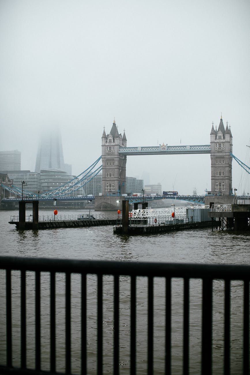
In The Turning Point, the literary scholar Robert Douglas-Fairhurst studies Dickens’s mid-career reinvention by zooming in on this single year, 1851. It was the year of the Great Exhibition in London. Marvels from around the world—an enormous diamond from India, saxophones from Paris—were displayed in the Crystal Palace, a colossal structure made of glass. (The young socialist polymath William Morris was reportedly so overcome by the exhibit’s crass materialism that he rushed from the glittering halls and vomited in the bushes.) Beyond the Crystal Palace, the world was becoming modern. The train and the telegraph made long distances feel short. Commentators hailed the progress of industry, as Britain’s robust manufacturing sector exported textiles, steam engines, and more. Yet the streets of London teemed with the starving and desperate. Raw sewage caked the banks of the Thames. Prescient British scientists warned that the destruction of tropical rainforests could yield “calamities for future generations.”…

In late November, Dickens began the work that became Bleak House, determined to wrest the chaotic realities of a world in flux into a narrative shape. Earlier industrial or “social-problem” novels by authors such as Elizabeth Gaskell and Benjamin Disraeli had aimed to document the suffering of workers and poor people; Dickens himself had presented a scorching critique of the Victorian workhouse system in Oliver Twist. With Bleak House, however, he sought to do something different: assimilate the new sensations of urban capitalism—marked by bewilderment, bureaucracy, and the collision of strangers—into a multi-plot novel…

Some authors find it necessary to maintain distance from the society they’re writing about. Dickens felt the opposite. The world he created in Bleak House arose from his enmeshment in the city of London and his familiarity with the streets on which he walked as many as 20 miles a day. From its first word—“LONDON”—Bleak House announces itself as a study of contemporary urban life…

Through images of shared engulfment—fog, mud, disease—Dickens joined together seemingly disparate elements of modern life. He also presented an implicit case for social reform. By tracing the vectors that link various levels of society, such as disease, kinship, and the simple fact of shared residence in London, Dickens encouraged his readers to think of the rich and the poor as, in Douglas-Fairhurst’s summation, “parts of the same story.” Processing the chaos of London through a powerful and idiosyncratic imagination, he depicted a community bound together in a common fate.

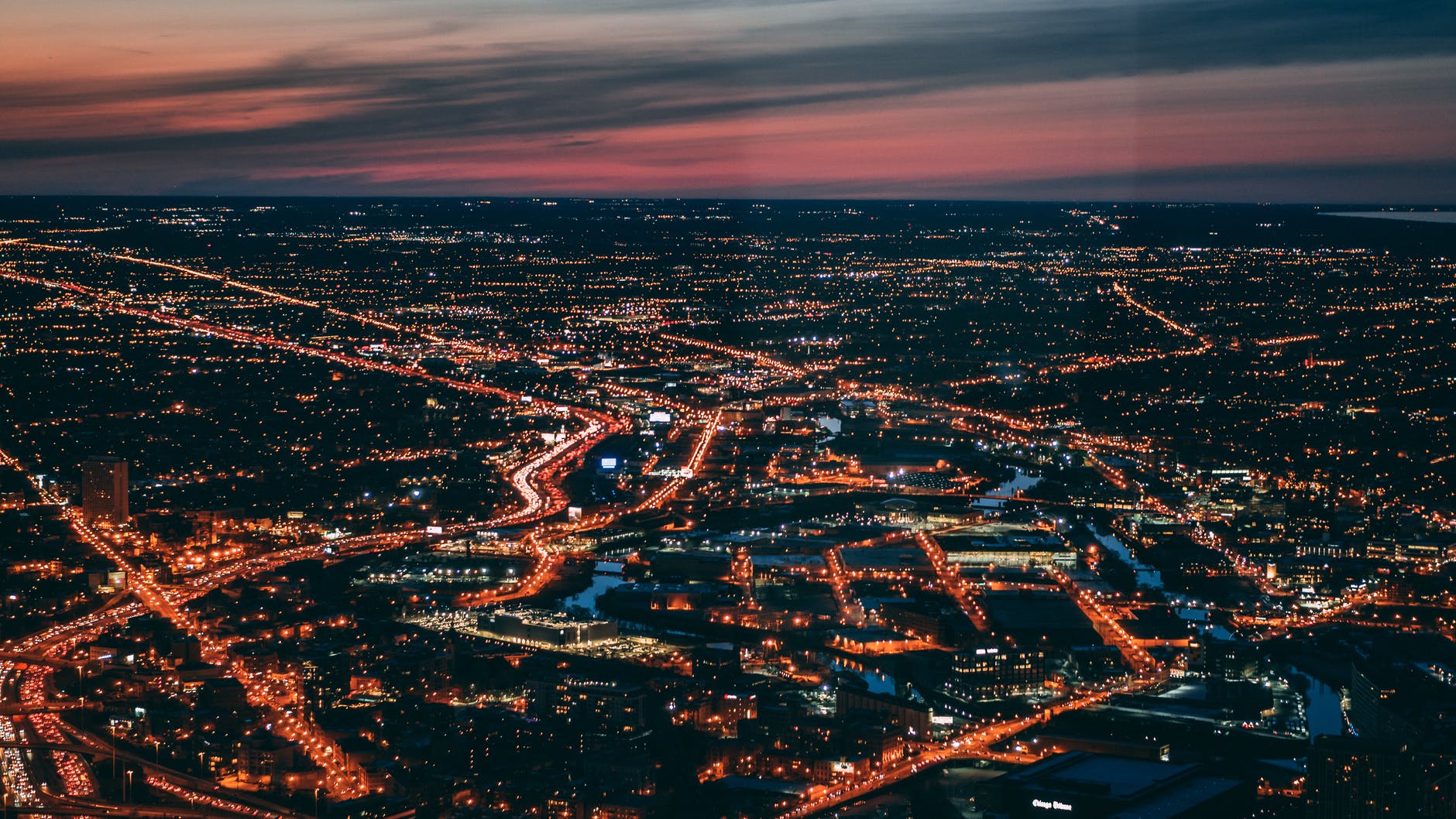
The growing cities of Europe in the 1800s did not escape the attention of writers, sociologists, and others. The speed at which cities grew and changed was unprecedented. I would argue that what it all means for human life and society is still being sorted out as we examine and adjust to a highly urban world with huge population centers.

Examining the city in the novel – and in other creative forms – is essential for helping people make sense of new phenomena. It is one thing to produce a factual report about urban change; this number of people moved, here are the conditions in which people live, here is the amount of money flowing in and out, etc. It is another thing to tell the stories of people there and then connect those stories to each other and to the larger whole.

As an urban sociologist, I would be very interested in a literature course that addresses urban novels and literary works.

Why people do not flock to the American cities that keep showing up in the most affordable places to live

I recently saw another list of the most and least affordable metropolitan areas in the United States with a key metric of how many families in the region could purchase a home at the median price. Here are the five most affordable places:

Photo by Ketut Subiyanto on Pexels.com

Home prices and incomes vary widely, and there are oases of affordability, mainly in the Rust Belt and Midwest. The top five most affordable places among metro areas with population of 500,000 or more:

Lansing, Michigan: As a result of modest home prices, 90.6 percent of all new and existing homes sold in the fall months were affordable to families earning the area’s median income of $79,100. The median home price was $155,000 in the fourth quarter of 2021, the builders’ index says.

Scranton-Wilkes Barre-Hazleton, Pennsylvania: Wages here are below national levels, but so are home prices — the median sale price was $150,000 in the fourth quarter. As a result of rock-bottom prices, 88.5 percent of all new and existing homes sold in October, November and December of 2021 were affordable to families earning the area’s median income of $70,600.

Pittsburgh: This metro area has a median family income of $84,800 and a median home price of just $166,000. As a result, 88.4 percent of homes were affordable for typical earners.

Indianapolis. This metro area has a median family income of $81,600 and a median home price of $215,000. As a result, 87.6 percent of homes were affordable for typical earners.

Akron, Ohio: With a median family income of $83,300 and a median home price of $165,000, fully 86.5 percent of homes were in reach of median-income families in the state capital.

Two features quickly stand out: the homes in these regions really are cheap (particularly when compared to local earnings) and they are all in the Midwest/Rust Belt.

Still, I have seen some version of this list many times now and I am not sure what to make of them. Why aren’t people moving to these locations?

The most obvious answers to me: it is not necessarily easy to move and these cities are perceived to have a lack of opportunities (economic, cultural, housing, etc.). American geographic mobility as a whole is down but do people actually move just for cheaper housing? What this list does is highlights that median income families can access median level housing in these five places. Get a decent job and owning a house is possible.

There are other possible answers that get more complicated:

  1. People just do not think of the Midwest/Rust Belt when thinking of places to live. Lack of opportunities, the weather, the middle of the country, a Midwestern blah-ness, etc.
  2. It is not just about a lack of opportunity; these are places seen as on the decline. Even if they are cheaper, who wants to live in a place that has already seen its best days when “growth is good” is a key marker of communities?
  3. These communities are lacking incentive campaigns to try to attract new residents.
  4. These communities may not want too many people to move in because it could drive up prices and bring in outsiders. (Yet, growth is good and many declining communities would do a lot to become a destination again.)

In sum: some American metropolitan areas are much cheaper than others, they have common characteristics, and there are a number of compelling reasons why people do not move to the places with cheaper housing.

Hot rental market in Phoenix and supplying enough housing

In an article about a large and expanding encampment of the homeless in Phoenix, here are some details about how rental prices in the city have shot up:

Photo by Justin Nealey on Pexels.com

“People say, ‘Are you surprised?’ And I say, ‘No, not really, because all of the housing forces in Phoenix and Maricopa County have been working against us for years,’” said Human Services Campus Executive Director Amy Schwabenlender, who works in the area with the encampment, sometimes referred to as “the Zone.” “We’ve had ongoing population increases in Phoenix and Maricopa County. We haven’t had housing production at all income levels keep up and meet that increase in population.”

Real estate investors are pouring cash into Phoenix and driving up prices. Rents there have spiked 25.6% over the past year, compared to a 15.9% increase in the U.S. from January 2021 to January 2022, according to data analyzed by Zillow. (Other popular Sun Belt cities like Miami and Tampa have also seen dizzyingly fast increases in rent.) Vacancy rates in Phoenix, or the availability of places for people to rent, are also at their lowest in 50 years, according to the Arizona Republic

While much of the rest of the article focuses on addressing housing for the homeless, this sounds like a bigger issue. This is an area with a growing population: Phoenix is now the fifth-largest city in the US and had a little over 100,000 residents in 1950 before experiencing double-digit percentage population growth in all but one decade since. Housing opportunities, particularly in rentals, have not kept up. American sprawl often produces a lot of single-family homes but necessarily cheaper houses or multi-family units for those who cannot secure a sizable mortgage.

What can Phoenix and surrounding communities do? Addressing housing in the United States is a difficult task. It will take concerted effort across communities for years. It may not be popular. But, it is essential for ensuring housing for all who need it.

It would be great to have an example of a city and region in the Sun Belt – roughly Virginia to southern California – that has successfully addressed this even as they have experienced significant growth in recent decades. I do not know if there is a great example, outside of some places not becoming too popular such that it raises demand and housing prices.

Naperville’s status and Farley’s “Van Down by the River” performance inspired by Naperville bridge over the DuPage River

According to Naperville native Bob Odenkirk, he was inspired by his hometown when writing Chris Farley’s famous SNL skit “Matt Foley: Van Down by the River.”

Q: Speaking of “SNL,” that famous sketch for Chris Farley you wrote, about him living in a van down by the river — were you writing with Naperville in mind?

A: There is the DuPage River, and when I was writing that I did picture the bridge in Naperville over the DuPage. It was a bridge for stoners when I was a kid. Stoner kids hung out there. So this guy parking his van by a river — yes, that was the image I had.

There are several bridges Odenkirk could be referring to. Could it be this bridge (in a picture from nearly a decade ago)? This is a little removed from the busier downtown area and the more manicured areas of the lively Riverwalk.

Naperville has a reputation as a wealthy and large suburb with a thriving downtown and numerous high-status jobs. Does the image of a guy living in a van down by the river fit this or kids smoking pot by the DuPage River? Probably not and the city in recent years was not interested in marijuana dispensaries.

I cannot imagine a statue of Matt Foley near the DuPage River in downtown Naperville among the suburb’s collection of public art...but perhaps Odenkirk could eventually make the cut?

Complicated urban repairs: 20 years to repair 11 blocks of Park Ave above and below ground

Manhattan is dense, above ground and below ground. Hence, the city is planning for a 20 year project to to a portion of Park Avenue:

Photo by Vlad Cheu021ban on Pexels.com

The good news is the city finally has plans to restore 11 blocks of Park Avenue north of Grand Central to a semblance of its former glory, Bloomberg reports, expanding the median from a useless 20 feet to a potentially-rejuvenating 48 feet. That redesigned street could include bike paths, walking paths, and generally more space for things other than cars or pretty things for people in cars to look at as they drive by.

The bad news is many if not most of the people currently living and working in New York will not be around to enjoy it once it’s done. It will take 20 years to redesign these 11 blocks, according to the city’s Department of Transportation. Yes, you read that right. The project to redesign 11 blocks of a Manhattan street will not be completed until 2042.

But there is no mistake, according to both DOT and Kaye Dyja, Powers’s spokesperson. As Dyja explained, “The reason the construction is going to take a long time is because they’re improving the underground railroads leading to Grand Central, as well as redoing the ‘train sheds.’ This entails that they’re digging up the ground, so the construction will have to take place in stages which will end up taking many years to complete.”

The project Dyja is referring to is a massive $2 billion renovation of the Metro North infrastructure underneath Park Avenue from Grand Central to 57th Street. Park Avenue is a bridge over those tracks, and like many of the U.S.’s bridges, this one is falling apart, too. The project will involve ripping up sidewalks and the median of Park Avenue a couple blocks at a time, going section by section, down the stretch of Park Avenue. It is expected to cause more or less permanent disruption to the Midtown East area, to varying degrees, over the next two decades. 

As a kid, I remember reading books with cross-sections of underground Manhattan. Seeing all of that infrastructure needed for modern urban life – pilings for skyscrapers, subways, water pipes and sewers, etc. – was fascinating.

The flip side of that is the work it takes to make significant changes to such a system. It takes time (and money) to work around what is there and complete the work.

The time is one factor but I wonder about how the budgets will work over a 20 year period. Large American infrastructure projects can have a tendency to stretch in terms of time and budget as the work is underway.

I would love to say I will check in on this in twenty years but that is a long commitment…

Seeing 1930s Los Angeles streetcars in color

The fabled Los Angeles streetcar system is visible in a colorized video with added sound of the city in the 1930s:

The streetcar system is no more with numerous works discussing how it was dismantled amid a push for cars and highways. But, the video is a reminder that cars and streetcars operated together for at least a while as the city and region grew quickly. Both provided opportunities to travel throughout the area and utilized the same roadways.

It is also interesting how such altered videos – here with color and sound added – have the opportunity to change perceptions of the past. When even relatively recent history is displayed in black and white, it seems less vibrant and real. Throw in approximate sound and such video could help viewers feel as if they are back in Los Angeles nearly a century ago.

New publication – More than 300 Teardowns Later: Patterns in Architecture and Location among Teardowns in Naperville, Illinois, 2008-2017

I recently published an article in the Journal of Urban Design (online first) analyzing several hundred teardowns in Naperville, Illinois. Here is the abstract (and several of the pictures I took for the study depicting recent teardowns):

Analyzing before and after images of 349 teardowns between 2008 and 2017 in the wealthy and sprawling suburb of Naperville, Illinois, shows patterns in aesthetic choices and their fit in older neighbourhoods. First, the teardowns are significantly larger and have different features including larger garages and more windows. Second, over 60% of the teardowns feature Victorian styling. Third, the teardowns are often next to other teardowns in desirable neighbourhoods near the suburb’s vibrant downtown. These visual findings show how teardowns that add to the housing stock often imitate common architectural styles yet exhibit disparate features compared to older neighbouring homes.

This project had several starting points.

First, I started studying the phenomenon of McMansions back in graduate school and eventually published a study looking at how the term was used in the New York Times and the Dallas Morning News. The idea of a McMansion has multiple dimensions – size, relative size, poor architecture and design, and a symbol for other issues including sprawl and conspicuous consumption – and the word can be used differently across locations.

Second, I started studying Naperville in graduate school as part of a larger project examining suburban growth and development. I published some of this research in two places: (1) examining consequential character moments in different suburbs, including Naperville, and (2) analyzing the surprising population growth in Naperville that helped take it from a small suburb to a thriving boomburb. Naperville is a unique suburban community with lots of teardown activity in recent decades.

Third, I am broadly interested in housing. This is particularly important for suburbs where owning and protecting single-family homes – and all that comes with it – are primary goals. Additionally, residential segregation based on housing is a powerful force in American society.

All three of these streams helped lead to this project. And there is a lot more that could be done in this area as teardowns affect numerous neighborhoods and communities in the United States.

Chicago aldermen and affordable housing, public housing

HUD is examining the connection between the power of Chicago aldermen over zoning and development in their wards and affordable housing in the city:

Photo by Chait Goli on Pexels.com

Housing activists and lawyers filed a complaint over aldermanic prerogative with HUD in 2018, alleging that allowing aldermen de facto veto power over most development proposals in their wards promotes housing discrimination by keeping low-income minorities from moving into affluent white neighborhoods.

The complaint against the city alleges that “aldermanic prerogative” helps residents who fear racial change pressure aldermen to block affordable housing projects by publicly raising concerns over school overcrowding, declining property values and other “camouflaged racial expressions.”

HUD officials continue investigating the matter and sent a letter to aldermen Dec. 1 asking them a series of questions about aldermanic prerogative, including how they define the term.

This reminded me of how aldermen helped shape the locations of public housing projects after World War Two. From the Encyclopedia of Chicago:

When Congress passed the Housing Act of 1949, which provided substantial funding for public housing, CHA was ready with a map of proposed sites for projects to be built on open land throughout the city, but the city council rejected this map altogether. White aldermen rejected plans for public housing in their wards. CHA’s policy thereafter was to build family housing only in black residential areas or adjacent to existing projects. This rejection explains the concentration of public housing in the city center on the South and West Sides.

In a city marked by residential segregation, numerous methods for keeping Black residents out of white neighborhoods, and white flight away from the city, the protection of certain areas has been a major emphasis. Affordable housing and public housing are typically viewed as unattractive land uses in whiter and wealthier communities with residents and leaders expressing concerns about property values, safety, and other matters with a sometimes stated and sometimes not underlying factor of race and ethnicity.

The need for affordable housing is great in Chicago, as it is in a number of major cities. But, who will compel neighborhoods or communities to accept that affordable housing should something everyone should bear responsibility for? Outside of some court cases and occasional legislative (Illinois and California as examples) or executive branch rumblings, the deck is stacked against affordable housing for multiple reasons. This includes an American emphasis on local government, particularly concerning local zoning and land use which is often set up to protect single-family homes. Americans often elect local representatives with the idea that they will protect the voter’s neighborhood and way of life.

Less clear from this article is what exactly HUD or others would if they find aldermen restricted affordable housing in the city.

Median home values in Austin more than double in one decade

In the last decade, housing values have jumped a lot in Austin, Texas:

Photo by Pixabay on Pexels.com

A decade ago, Austin, the capital of Texas often deemed a liberal oasis in a staunchly conservative state, was among the most affordable places to live. Now, according to a forecast prepared by Zillow, a real estate company that tracks affordability, the Austin metropolitan area is on track to become by year’s end the least affordable major metro region for homebuyers outside of California. It has already surpassed hot markets in Boston, Miami and New York City…

Home sale prices in the city of Austin skyrocketed to a record median of $536,000 in October, up from about $441,250 a year ago. And they have more than doubled since 2011, when the median sales price was $216,000, according to the Austin Board of REALTORS, a trade group. Rentals, too, have surged, with the average cost of an 864-square-foot apartment now $1,600.

Much of this article addresses the effects on the city and residents. The rapidly rising costs have consequences for many.

Thinking beyond this particular city, I wonder at the convergence of people, business, and real estate in the last decade in one city and region. Particular communities, including cities and suburbs, have experienced this before during boom times. Is Austin’s case unique or is it simply the latest American community to go through such growth? Austin has a unique mix of tech industry, cool culture, it is the capital of an important state and home to the flagship university in the state system, and once had cheaper housing.

At some point, the pace will slow down in Austin. This could happen because of the rising real estate values or other factors. What community and region is next? Based on what made Austin successful, I could venture some guesses. The first places that come to mind are on Richard Florida’s lists of creative class havens in The Rise of the Creative Class. Or, perhaps the tech industry gathers in a new yet unlikely location that offers similar advantages.

For five years running and the highest priced real estate by close to $2 million: America’s most expensive zip code

One way to consider the geographic concentration of wealth in the United States is to look at the most expensive zip codes. The leader is both persistent and has housing costs significantly above others on the list:

Photo by cottonbro on Pexels.com

“Reaching a new record median sale price at $7,475,000, Atherton’s 94027 remains the #1 most expensive zip code in the U.S. for the fifth consecutive year — nearly $2 million ahead of the runner-up,” the real estate property firm said in a news release. “Not only that, but the billionaire favorite also saw its median rise 7% year-to-year, suggesting that this exclusive enclave may continue to retain its leading position in the future.”…

The list of the ten most expensive zip codes includes several locations in the Bay Area, one in the Boston area, one outside New York City, one in Miami, several in southern California, and one outside Seattle. These are not surprising given the money in such locales plus the high real estate values in these markets.

At the same time, the Atherton zip code stands out. The housing is almost $2 million higher than other desirable locations. This does not necessarily it has the most expensive properties in the United States but it does speak to the uniformity across the zip code. And this has been the most expensive zip code for five years running. There is consistency which could be related to development activity (or a lack thereof), demand for housing in that particular place, and local regulations and zoning.

Even as numerous scholars have studied the concentration of poverty in certain locations or gentrification and changes in particular locations, I have not read as much on the concentration of wealth. How often does top-end wealth change locations? I would guess at least some of the zip codes in the top ten have been significantly wealthy for a long time. However, locations can change, new industries arise, and capital can move and real estate fortunes change. How different would a similar list be several decades ago or a century ago in the United States?