What you see when you drive in American cities: signs

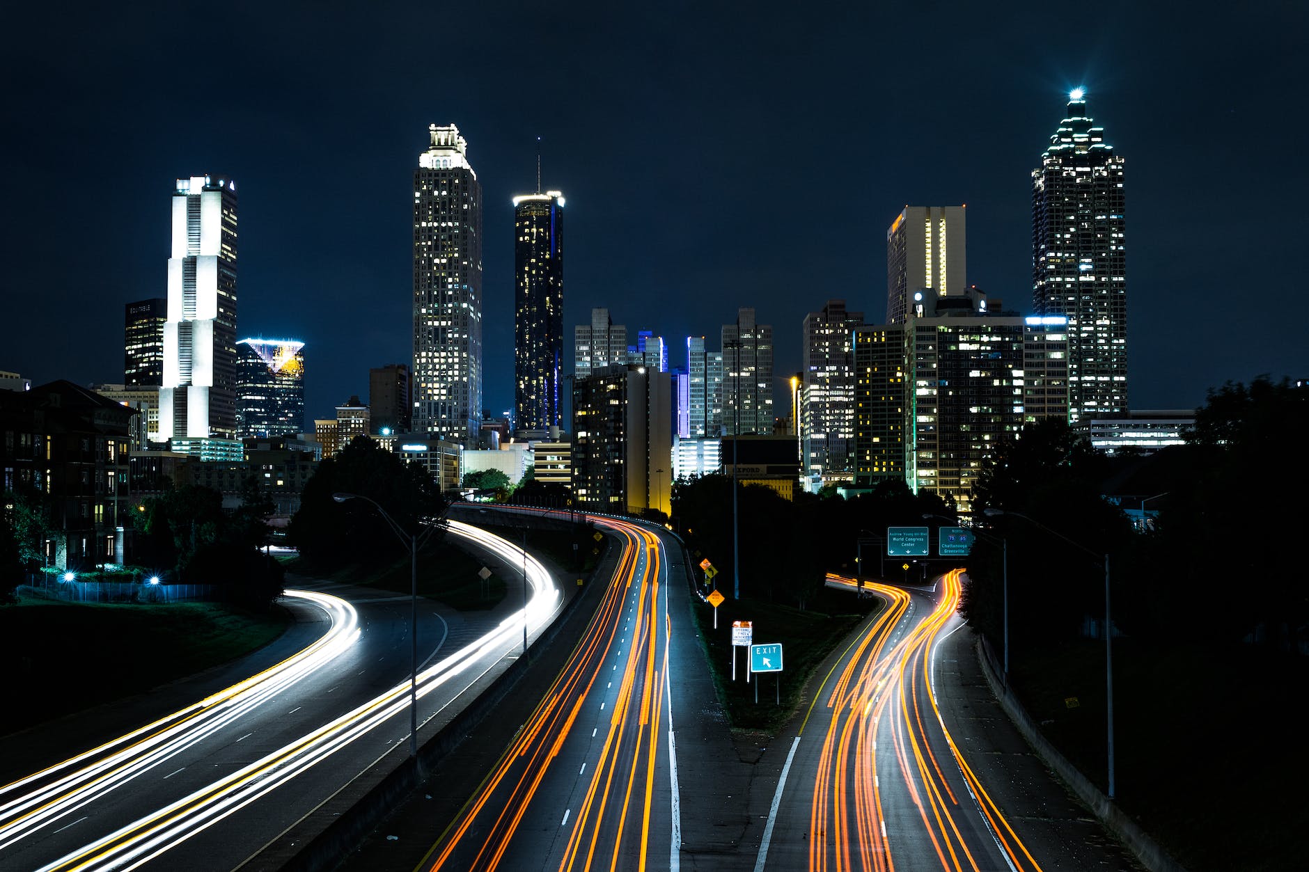
After seeing plenty of vehicles and buildings while driving recently through cities, I also observed a lot of signs. When driving at fast speeds, large signs are necessary so that drivers can read them and so that they catch people’s attention.

Photo by Charles Parker on Pexels.com

What can be learned from these signs? Here are a few of the domains:

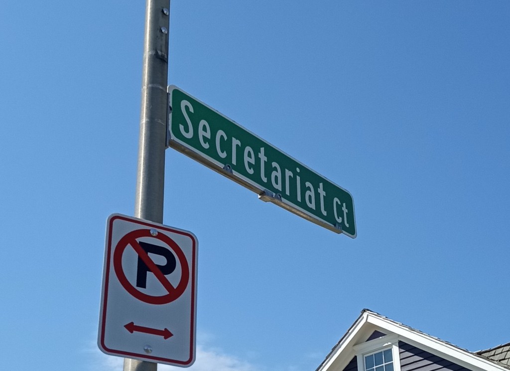
-Information about roadways. From street signs to exit signs, there is a uniformity to information drivers need to navigate. These signs can help a driver navigate a complicated city full of other vehicles and buildings.

-Information about goods and services. Advertising signs are all over the place. They might be for a particular brand, a product, a store or restaurant, or an experience. While road signs are bland and to the point, advertisements tend use more images and text to deliver a particular message.

-Information about local attractions. These could be simple notes on highway signs for a stadium or park or more elaborate advertisement for specific local institutions.

In other words, there are a lot of signs vying for a driver’s attention. If there is time to read even most of the signs (such as being stuck in traffic or at an intersection), they can reveal much about the location and the city. But, add all these signs to the buildings and vehicles and it can be hard to take it all in.

What you see when you drive in American cities: buildings

Continuing a short series on what I observed of cities in recent driving journeys, I noticed many buildings. This included residences, businesses, office buildings, schools, skyscrapers in the bigger cities, and more. Some are newer, some are older.

Photo by Joey Kyber on Pexels.com

Driving by at a fast speed, it is easier to observe a sizable building. A really tall structure might be visible for miles. A long structure means a driver has a few seconds to see the building while driving by. Small buildings go by really quickly. The single-family home, an American favorite, is hard to see well at high speeds.

The scale between vehicles, buildings, and roadways can be interesting. Highways might be above the ground, at ground level, or below ground. Because of the highway speed, they are not at the same spatial scale as local roadways. Buildings can tower over a roadway, making it difficult to see over or around them.

The view from the highway does not always present the best side of buildings. In denser areas, the back side of buildings tend to face the highway as their primary orientation is toward a local street. However, some buildings, including suburban office buildings, are set back a bit more from highways and offer different views. Driving down major roads (not highways) in cities can often present a range of structures within a short amount of space. In a land where land uses can be rather uniform in places, the variety of urban structures can make for a fun sight.

While this is not new, I was reminded on these recent drives that many American buildings have hard or cold exteriors. This means a lot of brick, stone, metal, or glass. These materials might be durable or fit a particular style, but this does not mean the buildings necessarily look inviting or warm.

What you see when you drive in American cities: lots of motor vehicles

In recently driving in and around several big cities, I was struck by what I could (and could not) see. I certainly observed a lot of motor vehicles on highways and roads.

Photo by Miguel Barrera on Pexels.com

It is long evident that Americans prioritize cars and trucks on their roads. There might be room for some pedestrians (be safe!), mass transit, and bicyclists and scooter users but these are not as numerous as all of the cars and trucks.

The range of vehicles really does run the gamut. On the same major roads, one can find all sorts of trucks (delivery trucks, dump trucks, tankers, car carriers, etc.) and cars ranging from expensive luxury models to those who look pieced together to newer electric vehicles. If I wanted to see what Americans are driving for personal and business trips, I would recommend driving some of the highways that go right through urban centers and one can observe a wide variety.

Even with at least some people working from home, there are plenty of vehicles at many hours of the day. For many residents and companies, it is easiest to go via vehicle than other option. Driving is still a preferred method, even in cities with busy roadways.

If a driver truly wanted to be safe and only focus on the road around them, there is plenty to see. On many of these busy roads, tens of thousands or even hundreds of thousands of vehicles might pass by each day.

Pedestrian deaths in US hit record, continue to rise

Keep safe, American pedestrians:

Photo by Ketut Subiyanto on Pexels.com

More than 7,500 people were killed last year after being struck by vehicles while walking along or across U.S. roadways — the most pedestrian deaths in more than four decades, according to a new report.

This sobering trend was not surprising to experts who track the numbers. But they were dismayed by the consistent increase — up 77% since 2010.

The article goes on to suggest multiple possible reasons for the increase. In a society that privileges driving, pedestrians need to exercise caution.

From a social problems perspective, at what point would pedestrian deaths become a sufficient issue that people and governments would devote significant resources to addressing it? I am trying to imagine a pedestrian lobby that brings together different groups and it is hard to envision such a movement coming together. Perhaps it requires major marches on population centers? Could local walkers or walking groups join together with park districts, outdoor companies, and others with a stake in pedestrian activity to collectively act? The ability to walk safely should be prioritized, but it is not the primary concern in transportation or with roadways.

(Additionally, American roadways are not safe for drivers either. According to one source, “The United States has the most traffic deaths per capita of any developed country.”)

Finding the closest road named after Secretariat among the varied road names of suburbia

I recently had a reason to drive by the nearest roadway named after Secretariat:

This is a short roadway. True to being a “court,” it is a cul-de-sac with roughly seven houses along it. According to Google Maps, it is about 250 feet long.

When I wrote about this one month ago, I had this road in mind. Did the name transform the surroundings and/or elevate the late 1980s suburban neighborhood due to the prestigious athlete? Not particularly. Is it a unique name? Yes, but one shared by over 200 other locations in the United States.

Perhaps the biggest difference between this specific street and those nearby is that it is a recognizable or more unique name. For example, here are some of the more anonymous streets within a mile or so in sprawling suburbia: George Street, Jeffrey Court, Hamilton Drive, Rose Court, and Christina Circle. These might be named after specific people but it is hard to know decades later.

Secretariat lives on in this suburb in a way that LeBron James or Tom Brady or other people in the running for the best in their sports probably never will.

Paris discourages use of cars so underground parking garages need to change

If Paris has fewer cars on its streets, what happens to its underground parking?

Photo by Daniel Frese on Pexels.com

Today Indigo operates 2,700 garages on three continents. But it’s here in Paris, where the company now manages more than a third of publicly accessible garage parking, that Indigo is beginning to develop a new underground commercial ecosystem. There are car repair shops, car rental offices, and click-and-collect lockers from Amazon. Larger-scale ventures the company is pioneering for lower levels include storage facilities and data centers. One private, non-Indigo garage has even been turned into a farm for mushrooms and endives.

Retrofitting parking is complicated, said Arnaud Viardin, Indigo’s director of partnerships. Counterintuitively, garage floors have less load-bearing capacity than homes or offices. Garages also have very low ceilings, threaded with beams and utility conduits that can limit adaptive reuse: It’s hard to market a storage facility that’s not accessible by box truck. Energy-intensive vehicle chargers require drilling through concrete to lay new electrical cables, and just about anything you do demands a time-consuming review with the Fire Department. Rarely do these new leases pay more than a constant stream of drivers charged hourly parking rates. But they pay more than an empty parking garage.

Indigo’s underground real estate has few competitors. Hundreds of thousands of square feet are now dedicated to alternative uses across France, mostly in Paris. “Finding real estate under Place Vendôme, under Place Dauphine?” Fraisse put it to me, pointing to two of the capital’s ritziest addresses. “We’re capable of proposing square footage at prices that have nothing to do with what you’ll find aboveground. Ten, 20, 50 times cheaper.”…

For logistics clients, the value of Indigo’s space is hard to beat. MonMarché is a spinoff of a larger French grocery chain, Grand Frais, whose stores are suburban big boxes with ample parking. “We had to find another solution for the Parisian market, which is the biggest,” said Demond, slicing open the packing tape on a Styrofoam box of durian, the odoriferous East Asian fruit. “The cost of real estate is so high.”

Cities have gone underground for numerous reasons: space above ground is limited, certain land uses are less desirable, underground uses can be more efficient. Putting cars underground made a lot of sense in previous decades when there was a lot of traffic and parking aboveground takes up a lot of space.

How far can underground redevelopment of parking garages go? Would people be willing to spend long amounts of time in such spaces if they were adapted for commercial, office, or residential use?

If these underground spaces become desirable opportunities, how high might rents and resale values go?

What are the odds the new Kennedy Expressway construction ends in 3 years?

Chicago area drivers will soon face another major construction project, this time on the Kennedy Expressway, for several years:

Photo by Chait Goli on Pexels.com

The $150 million project will take place along a 7.5-mile stretch from the split at I-94 south to Ohio Street, and at the massive underpass near Hubbard Street downtown. It will include rehabbing 36 bridges and the highway’s reversible express lane access system, replacing overhead signs, upgrading lighting, paving and painting.

The work is designed to improve safety, traffic flow and reliability on the 10-lane expressway, used by more than 275,000 drivers each day, the Illinois Department of Transportation said. The last major rehabilitation of the 63-year-old roadway was in 1994, and bridges were last repaired a decade ago.

Construction is expected to take place in phases over the next three warm-weather seasons, starting with the inbound, or southbound, lanes this year…

The outbound work and the updates at Hubbard’s Cave are expected to be complete in late fall 2025.

The last major road project nearby went over budget and over time. Are there publicly posted odds regarding this project?

Given the importance of this stretch of highway for the Chicago road network, it is hard to say that the construction should not happen. Even as the cynic might note that as soon as this project is over the next stretch of the Kennedy will be under construction, roads do need repair. But, what are the consequences if the project is not completed on time? Are there any significant incentives that can help make sure this project stays on track and within budget?

It does not help that the timeline for this project is so long. At some point, the regular driver on the Kennedy may have a hard time remembering when the road was not under construction. In fall 2025, how many will remember the optimism of a prediction of 3 years? If it goes into 2026 and the cost went up some, how many will care? I will set a mental note for late 2025 but we will see what happens…

Two numbers that show how much space the United States devotes to parking

The United States has a lot of parking:

Photo by Brett Sayles on Pexels.com

The United States has about two billion parking spots, according to some estimates — nearly seven for every car. In some cities, as much as 14 percent of land area is covered with the black asphalt that engulfs malls, apartment buildings and commercial strips.

In a country where driving is an essential part of the regular and idealized way of life, space is required for vehicles when they are not in use. Most locations requires parking so people can drive and park there. Communities accrue a lot of parking, sometimes for parking that serves multiple locations (such as a downtown parking garage) and sometimes for a single use (like a parking lot in front of a big box store).

Increased density would help solve this problem without necessarily asking for people to drive less. Put desirable locations near each other and then centralize parking or share parking facilities so that parking is not unnecessarily duplicated. If “surban” developments are more popular or “fifteen minutes cities” emerge in greater numbers, perhaps this might help.

Less driving could also help. As could expectations about how much parking is needed; it is for peak and unusual times that rarely occur?

If enough places and concerned actors are able to slow the growth of parking lots and/or eliminate some, it is interesting to imagine communities with fewer parking spaces in the future. How might such land be positively used?

How much will Sunbelt growth slow because of more traffic?

More development and increased populations mean more traffic in multiple Sunbelt metropolitan areas:

Photo by Joey Kyber on Pexels.com

In most U.S. cities, traffic is less congested than it was in 2019, as fewer people commute to offices, according to mobility data company Inrix. In some Sunbelt cities, such as Miami, Nashville and Las Vegas, where the population has surged in recent years, it has become worse. 

These cities also attracted more companies and tourists during the pandemic. Local roads, built decades ago for a much smaller population, are struggling to accommodate the new reality. 

“They way underestimated their growth,” said Robert Cervero, professor emeritus of city and regional planning at the University of California, Berkeley, College of Environmental Design…

Sunbelt cities are particularly vulnerable to congestion because of poor public transit. Driving in New York City’s rush hour can be bumper-to-bumper, but many people take the subway. Most southern cities offer no such alternative…

For now, Sunbelt states are hoping to fight congestion by adding more roads and express lanes. Tennessee lawmakers are considering a proposal to add toll lanes on state roads. Florida Republican Gov. Ron DeSantis recently proposed spending more than $5 billion on highway construction and more than $800 million on rail and transit throughout the state.

Growth is good in the United States – until it threatens some of the attractive features of places that brought people there in the first place.

At what point do residents and businesses not move to growing regions because of congestion? These Sunbelt cities continue to have numerous attractive features even if they have more traffic.

Adding lanes to roads may appear proactive but it can lead to more attractive as more drivers think there is capacity. Considering mass transit is necessary but complicated by suburbanites who do not necessarily want transit to reach them, high costs to get basic mass transit in place (though this could help save money down the road), and limited interest in denser development.

Do smaller cities offer advantages here? I have heard this argument before: you can have more rural property conditions within a ten to twenty minute drive of the main shopping areas or the downtown. Achieving this is more difficult in a more populous area where there is more competition for land.

The long wait for a train station parking permit in Naperville is ending

The busy Metra commuter rail train stations in Naperville meant that it could take years to get a parking permit. That is no longer true:

Photo by Pixabay on Pexels.com

All parking spaces in Naperville commuter rail lots will transition to daily fees in the coming months.

The Naperville City Council Tuesday voted to eliminate the parking permit system at the Route 59 and Naperville/Fourth Avenue Metra rail stations and require commuters to pay only for the days they park…

Even before the COVID-19 pandemic changed the frequency people commute to Chicago, city staff was working to address the problem of spaces not be used in permit lots.

Effective immediately, no new permits will be issued for any Naperville commuter parking lots.

In the coming months, staff will modify the municipal code for council consideration with a goal implementing the daily pay-by-plate fee model in July…

When demand does return, the city can look into implementing more technology, such as parking guidance and reservations systems, Louden said.

This is a big change in a community where finding parking at the train station was difficult for years. Suburbanites are often used to plentiful and cheap parking so both a waiting period for a permit and a shift to a first-come-first-served model can irk different people.

It would be interesting to hear more about how changing work patterns – more work from home, perhaps more suburb to suburb commuting over time compared to trips into Chicago – affect suburban life. Are we in for a significant reckoning with commuter rail and mass transit when fewer people use it regularly for work? How about big parking lots: do they survive? Or, do suburban schedules change when fewer people work 9-5 shifts?