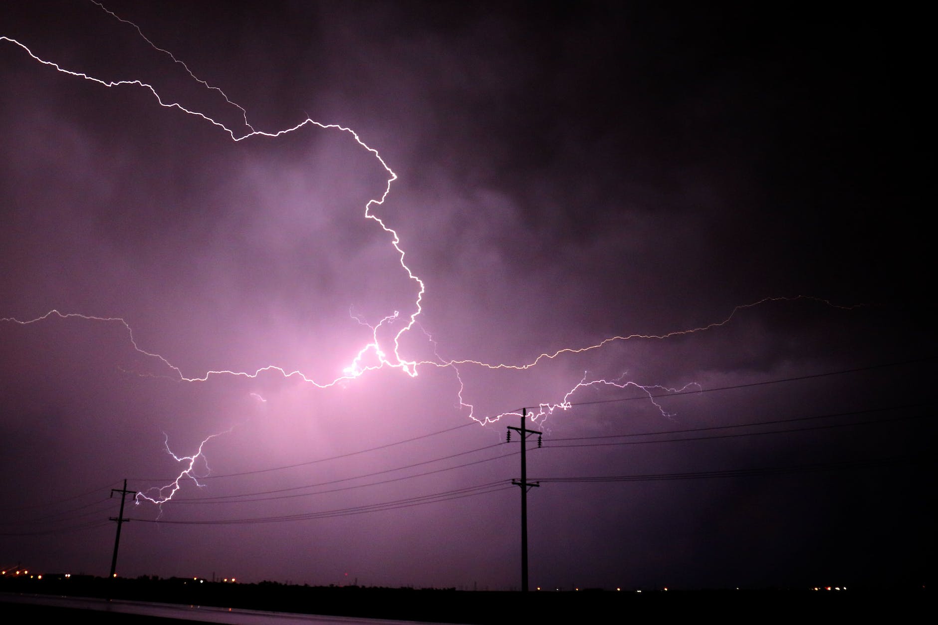
But a more significant influence on the rising storm damage trend has little to do with the weather: Growth and development patterns mean there are many more homes and businesses in the way of tornadoes, hail and damaging winds than there were decades ago…
The trend is a product of growing populations in regions where severe storm impacts are also increasing, said Adam Smith, a NOAA economist and scientist who tracks the events.
Researchers call it the expanding bull’s eye effect — a larger target for storms and tornadoes makes it easier for them to inflict damage.
For example, in outlying parts of a city like Wichita, a tornado that might have affected 20 homes several decades ago could now damage 2,000 homes in the same footprint, said Walker Ashley, an atmospheric scientist at Northern Illinois University.
Given the propensity toward sprawl in the United States, would any developer or local leader or potential suburban resident say no to more sprawl to avoid storm damage?
It starts with “where we are on the globe,” North Carolina state climatologist Kathie Dello said. “It’s truly a little bit … unlucky.”
China may have more people, and a large land area like the United States, but “they don’t have the same kind of clash of air masses as much as you do in the U.S. that is producing a lot of the severe weather,” said Susan Cutter, director of the Hazards Vulnerability and Resilience Institute at the University of South Carolina…
With colder air up in the Arctic and warmer air in the tropics, the area between them — the mid-latitudes, where the United States is — gets the most interesting weather because of how the air acts in clashing temperatures, and that north-south temperature gradient drives the jet stream, said Northern Illinois meteorology professor Walker Ashley.
Then add mountain ranges that go north-south, jutting into the winds flowing from west to east, and underneath it all the toasty Gulf of Mexico.
The geography of the Untied States is often described as an advantage. Lots of land. Many natural resources. A range of temperatures and climates. Across the oceans from major global conflicts.
In this case, the unique geography leads to issues. The expanse and variation in land puts air masses in conflict.
As the article suggests, have American communities adapted to this? If bad weather and disasters are somewhat predictable, do we have structures and planning that mitigates some of this impact? Just as one example, suburban sprawl with its balloon-frame houses and reliance on driving could be prone to particular ill effects.
If we consider the city a geophysical entity, we can think about being tocado as a uniquely historical form of relating with the Earth. Rather than Elena’s affliction being induced by a traumatic experience and a fear of future earthquake events, she and others fear the processes that were initiated by the earthquake: the grietas, the slumps, the leans, the fissures, the buildings collapsing years later…
This is a form of seismic time that is not only knowable through a seismic event. It’s a time that begins with an earthquake but continues through ongoing geophysical and political processes. Rather than a pathological individual condition or a culture-bound form of expression, we might see being tocado as an emergent form through which bodies, histories, legislations and earths come into relation. Deep time, in Mexico City, is resolutely present if you are compelled to notice.
Deep time might be a useful frame for contemporary analysis, a temporal literacy that places the long-term ramifications of the present moment into a deeper history. Conversely, such scales also risk subsuming deep time into the present.
Mexico City points toward something more physical, a sense of time that neither collapses the human and the geological nor holds them as irrevocably distinct. In their embodied apprehension of earthly processes, people who are tocado reveal that deep time is not only an analytic problem of scale, but a stranger temporal geometry, where homes are at once sites of security and indifferent geophysical entities. Deep time portals open in the city’s many cracks, slumps and fissures, revealing an inconceivable horizon forever rushing forward.
The modern city is often designed to avoid deep time or a deep understanding of the past. The modern city of the last two centuries often took existing land and communities and created a city on a new scale with new materials with new possibilities.
In this article, the primary point of departure from modern time are earthquakes that remind residents on what the city is constructed. Other features of cities that might do this could be other natural disasters, areas designed and established far before the advent of cars, ancient landmarks, and excavations that reveal the past.
But, I imagine many residents of such cities have limited interactions with a deep past. Take Chicago: what there would remind people of a deep past, let alone even a few hundred years before? And if residents and leaders did more regularly interact with the deep past, would they act differently in the cities that are now so important to modern life?
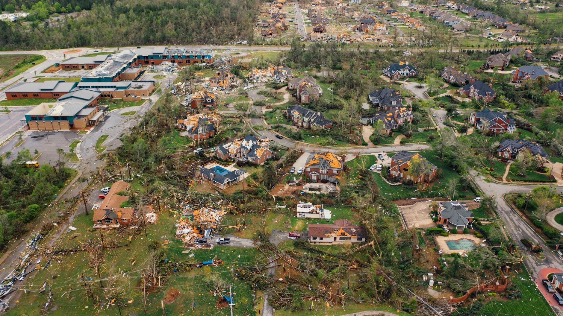
There may never be a full recovery for dozens of Naperville residents continuing to struggle in the wake of a devastating tornado that tore through sleepy neighborhoods shortly after 11 p.m. June 20, leaving one house destroyed and more than 200 damaged in an area just south of 75th Street…
Six months later, they and so many others continue to deal with slow-responding insurance companies, negligent contractors, supply-chain issues and a city government that’s never grappled with the long-term effects of devastation on this scale…
Some homeowners are simply choosing to sell for the value of the land. Others are dedicated to rebuilding no matter how long it takes…
City officials say they understand the frustration in the neighborhoods and acknowledge the difficulty in assessing resident needs. They’ve tried to expedite the permitting process — waiving fees is being considered if it directly benefits homeowners and not the insurance companies — and they suspended charging residents for utilities.
The feat of building suburban subdivisions can be impressive in its own right. When the mass construction of neighborhoods occurred regularly after World War Two, it represented a change to how housing was built.
Reconstructing suburban subdivisions might be a more difficult task. Rebuilding numerous homes and reconstructing daily lives amid normal suburban life is not easy. The advantage of building a whole subdivision at once is that all of the equipment, materials, and labor can be in place at the same time. When some homes are destroyed and damaged, it sounds like efforts are more scattered or focused on particular properties.
Since suburbs do experience tornadoes at least semi-regularly in the United States, is there a set of best practices communities and residents can follow? Putting homes and life back together after a calamity is never easy but perhaps there are clearer paths to resiliency.
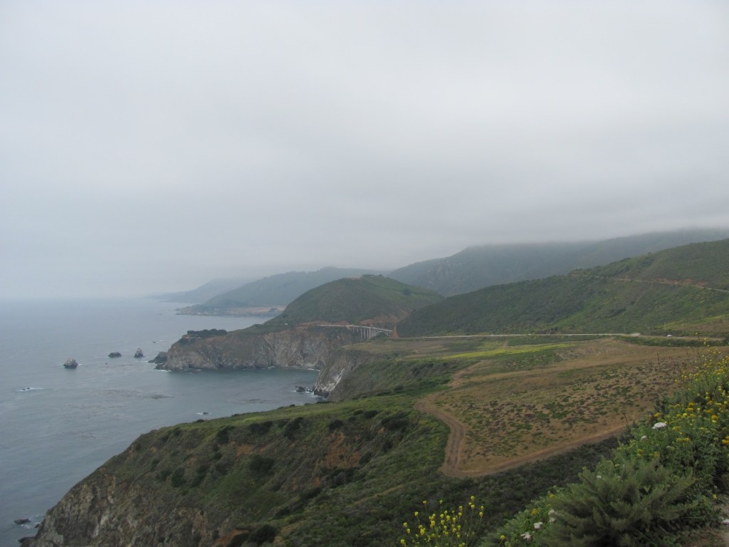
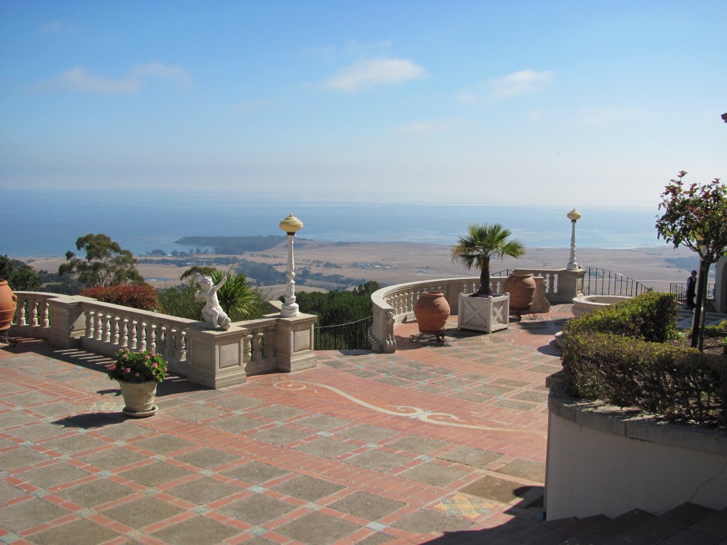
Over a decade ago, we planned a vacation that involved driving Highway One from San Francisco down the California coast. I had visited California several times before but had never driven this famous road. While our drive was relatively quick as we spent more time in urban centers, we enjoyed the scenery and the contrast of the roadway to typical straight Midwest roads.
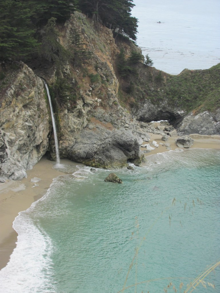
Highway 1 is a California spectacle, a Depression-era monument to the state’s quixotic ambitions and stunning beauty. It runs from the Orange County surf haven of Dana Point in the south into cannabis-cultivating Mendocino County, carrying heavy traffic over the Golden Gate Bridge and under the bluffs of Santa Monica, where it is better known as the Pacific Coast Highway, on its 650-mile route…
The engineering folly of a road built on sheer cliffs has meant that closures are annual events — the “whens,” not “ifs” — for the people and the economy it supports.
But the wild card now is the increasing frequency of wildfire along a roughly 100-mile stretch from William Randolph Hearst’s hilltop castle at San Simeon to Carmel, which is stripping fragile hillsides of stabilizing vegetation and causing more slides and more serious washouts across a region known broadly as Big Sur…
An even larger stretch of Highway 1 reopened in 2018 after a 14-month closure at Mud Creek about 20 miles south of here. The road was buried — not washed away, as in Rat Creek’s case — when the rocky ground above it gave way in hard rains.
This is one of the few times in my life where the road itself was a destination – and it was worth it. Keeping this corridor open is important even as it is a difficult stretch to maintain.
The 2011 earthquake that hit Christchurch, New Zealand offered an opportunity for a new approach to city life. What ended up changing? One writer suggests not much.
The Feb. 22, 2011, earthquake killed 185 people and had an unprecedented impact on the built environment of Christchurch, a city built by white settlers on drained swampland. More than 1,200 buildings inside the central four avenues were destroyed by the quake or by demolition crews in the years after. In the suburbs, a process called liquefaction was just as devastating. As the ground shook, water and sand squeezed up through the soil to the surface, leaving the soil to subside into the space the water had vacated. Houses slumped, and roads folded inward like the icing on a failing chocolate cake. In the hardest-hit eastern suburbs, the government eventually bought out and demolished about 6,500 houses, upending countless families.
One of the champions for this area of the city, which is demographically poorer and browner than the rest of Christchurch, was then-opposition MP Lianne Dalziel. She left Parliament in 2013 to contest the mayoralty, won, and is now in her third term. When I asked her about lessons to come from the rebuild, she immediately mentioned “Share an Idea,” an inclusive project run by the City Council in the months following the quake. “It was an opportunity for people to submit ideas about how they might reimagine their city,” she said. More than 10,000 people contributed over 100,000 ideas, which the council used to influence its draft central city plan. Share an Idea empowered the community, produced concrete recommendations for the future, and won international accolades.
In late 2011, the national government rejected that community-generated plan. Sidelining local politicians, the government came up with its own version, formulated behind closed doors in about 100 days. With much fanfare, the government announced a “Blueprint” for Christchurch that promised a brand-new city peppered with big-ticket items: a stadium, a library, a convention center, a giant indoor sports facility. The CEO of the government agency set up to oversee the rebuild said that “this new city will absolutely set an international benchmark for urban design, innovation, and livability.” The minister in charge, Gerry Brownlee, noted that “the plan and its implementation are being watched by the rest of the world.”…
A 2019 survey of 30,000 Christchurch residents found that just 29 percent of them thought that the city was better than it was before the quake. I lived in central Christchurch for about a decade, both before and after the quake, and I have to agree with the majority. Rebuilding this city was an opportunity to make something great; instead, 10 years on, we’re still talking about Christchurch’s potential. What lessons can other cities, rebuilding from disaster or redesigning in anticipation of change, learn from Christchurch?
Given how major cities operate today, this might not be a big surprise. Do city and civic leaders tend to listen to the people or do they go with decisions that enrich the interests of elites?
Sociologists have written about this. More broadly, the growth regimes/machines literature suggests that city decisions are made by a pro-growth coalition that can make money off development. The broader public has limited influence in big decisions.
More narrowly, studies like Crisis Citiesshow how communities react to large-scale crises. In the case of New York City after 9/11, much of the money and redevelopment effort went back into expensive property. In New Orleans, relatively little was done to help poorer residents and neighborhoods while more effort went into rebuilding the tourism industry.
This does not mean such change could not happen. But, it would be unusual. Without sustained effort from the larger community or unusual efforts from leaders to incorporate the community, redevelopment and cleanup will be aimed in a particular direction.
The housing market doesn’t yet factor in the risk of climate change, which is already affecting many areas of the U.S., including flood-prone coastal communities, agricultural regions and parts of the country vulnerable to wildfires. In California, for instance, 50,000 homeowners can’t get property or casualty insurance because of the increased risk to their homes.
Yet for now, no mortgage lender, portfolio manager or buyer of mortgages takes into account climate-induced floods, except to determine if a house sits in a 100-year floodplain at the time the mortgage is issued, said Michael Berman, a former official with the U.S. Department of Housing and Urban Development and former chairman of the Mortgage Bankers Association.
Once lenders and housing investors do start pricing in such risks, “There may be a threat to the availability of the 30-year mortgage in various vulnerable and highly exposed areas,” Berman wrote in a recent San Francisco Fed report. He predicts lenders could “blue-line” entire regions where flood risks are high — a reference to redlining, the practice of refusing mortgages to minorities…
Said Cleetus: “My biggest fear, honestly, is that the markets will get out ahead of our policies, and we see a situation where property values do start to decline, and small communities that rely on a lot of property tax revenue won’t be able to deal with it.”
It will be interesting to see who (1) pursues this as a competitive advantage and (2) how federal policy plays into this. In a quest to get ahead of the rest of the market, could someone come up with a unique mortgage for areas with more climate change risk? Discussions about whether federal money should be used in places prone to natural disasters has been going for decades (see Hurricane Sandy or discussions about resilient cities).
Much of the article focuses on how the lack of mortgages in certain areas would lead to decreased property values and then a downward spirals as communities would not be able to generate as much tax revenue. This could also work the other way: imagine communities where only the really wealthy can live because they do not need traditional mortgages. They could come in and gobble up real estate with lowered values. Either way, the result could be increased inequality in affected areas.
The municipal utility that serves Los Angeles doesn’t shut off power during high winds. As the utility explained in a recent press release, the city’s miles of pavement, numerous fire stations and relatively limited open spaces help protect it from runaway fires. There’s also the chaos that could ensue from knocking out traffic lights in the capital of car culture.
L.A.’s approach, however, isn’t foolproof. The Getty fire that’s chased celebrities from their hillside homes started when a broken eucalyptus branch sailing on the wind hit a live power line owned by the city’s utility. The Los Angeles Department of Water and Power did not return a call Wednesday asking if it would reconsider its no-blackout policy as a result…
San Francisco, meanwhile, benefits from its famously odd climate. While the rest of California heats up and dries out during the summer, San Francisco shivers in a fog bank so much a part of city life that residents have given it a name (Karl). The fog typically vanishes by October, but even then, the city never gets as dry as most of its suburbs. And the dangerous Diablo winds striking this month rarely hit the city as hard as its hilly suburbs.
As a result, San Francisco isn’t included on the state’s official map of high fire threat areas. So PG&E Corp. doesn’t cut its power when winds rise, said utility spokeswoman Ari Vanrenen. That’s not to say the city couldn’t someday lose electricity if PG&E takes down a transmission line that feeds it.
These reasons make some sense. Denser urban areas are less likely to have large areas of foliage and nature in addition to exposed power lines through which fires can easily spread.
At the same time, it might be difficult to make a case when many people in the state are affected by the blackouts and others are not “sharing the burden.” Do such choices provide economic benefits to certain areas while others are hurt?
The case of Los Angeles could get pretty interesting in this regard in that there are some more natural areas surrounding the city and separating communities. The Getty fire above is a good example; the museum and the surrounding homes sit on less dense land on hillsides overlooking the city. Could a fire break out there and then end up on either side of the hills/mountains and spread to urban and suburban land?
While they might look grand, LTHs are different from high value homes in a few key ways. Their location and design is similar across an entire subdivision, the construction materials are lower in quality, LTH construction practices are focused on efficiency, and other LTH construction costs are more predictable and less expensive. Despite those differences, insurers can run into problems when assessing the reconstruction bill for an LTH.
“A lot of times, the sheer size of them [means] a lot of carriers classify them with a much higher reconstruction cost when it comes time to rebuild,” said Benjamin Abbott, product manager for CoreLogic Insurance Solutions group, adding that the latest RCT Express release “allows carriers to visually see whether a home is classified as a large tract home or not. And if it is, then we turn down the reconstruction costs a little bit with our assumptions and allow the tool to more accurately price [the property].”
The valuation distinctions between McMansions and high value properties becomes important as natural catastrophes bear down on many parts of the US, at the same time as a lot of new homes are being built in the LTH model…
“It’s important for the insurance carriers to accurately value the reconstruction costs of any property they have because their client, the homeowner, is going to see the impact of that reconstruction cost directly in the premiums that they pay,” Abbott told Insurance Business. “Prior to this update and with other tools out there, they are potentially over-insuring, meaning that premiums may be inflated, which hurts the homeowners directly.”
Interesting assessment: the size of McMansions would lead to a higher reconstruction cost until the insurer considers the quality of the construction and the reconstruction cost drops. I assume this then means it could be cheaper to insure a McMansion than a different kind of home of a similar size?
More broadly, I wonder if insurance companies could provide data on McMansions:
Just how many McMansions/Large Tract Homes are there in the United States?
Because of the lower-quality construction of McMansions (as noted above), do McMansions have an above average number of claims on the home insurance over time? The lower-quality construction claim is a common one but we have not necessarily had enough years pass before we can easily see more issues with the longevity of McMansions.
Through federally funded flood insurance, huge appropriations for beach nourishment projects, and generous, well-intended relief aid, government policy allows developers and wealthy investors to build huge houses and hotels on beachfronts and low-lying barrier islands at high risk from coastal flooding as well as hurricanes. Uncle Sam’s generosity makes it all possible…
Writing just as the extensive damage from Hurricane Florence became apparent, Gaul covers the waterfront, so to speak — from Hurricane Katrina to South Florida, to the halls of Congress. In North Carolina, he stops Down East in Columbia, Creswell and other towns of North Carolina’s “Inner Banks,” where rising water levels and flooding are washing away entire communities…
According to Gaul, things began to tip in the 1980s, when multistory “McMansions” began to supplant the simple Cape Cods. (A similar trend has transpired on the north end of our state’s Outer Banks). Disasters such as the Ash Wednesday flood of 1962 did little to discourage development. On the contrary, real estate dealers saw storms as “clearing the market,” blowing down older, ramshackle structures and making way for the new, bigger units that buyers seemed to want.
Real estate prices went up, and increasingly retirees and residents with modest incomes were squeezed out. But there were always more customers in line for resort property.
I wonder if the primary objection is that big homes are being built and someone is profiting from the government money or should there be no homes on these properties? If the goal is to protect the beach and taxpayer dollars, less development in these areas is better. If the problem is profiting with the government’s money, there could be restrictions on the size of the new home or how the money is used.
It would be an interesting thought experiment to consider what this would look like without any government intervention. The argument here is that the government’s funding for rebuilding simply encourages the cycle of building larger and larger homes. If there were no regulations, what would the market bear? Or, as the author seems to suggest, would different regulations be better for the long-term fate of the beach and tese communities?